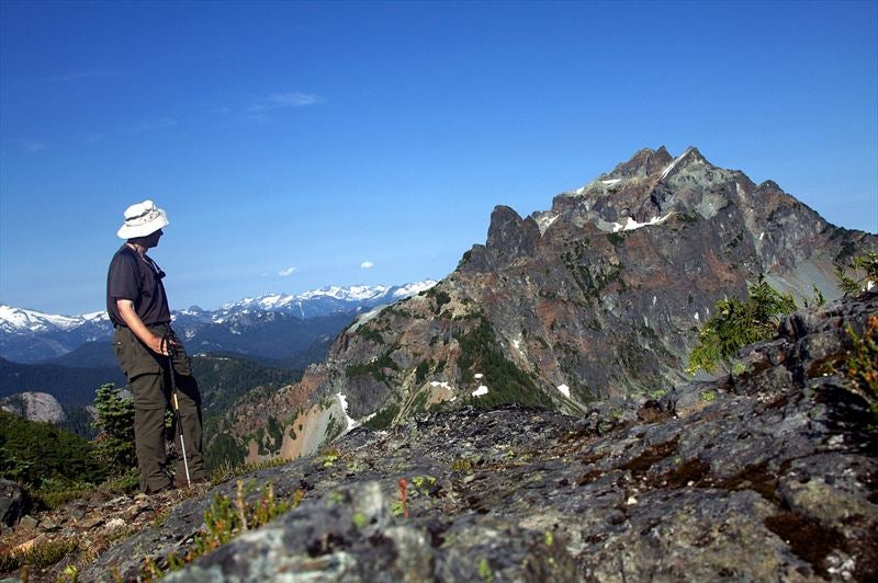
BC Coast Alpine is not easy to get to. You have to exact pound of blood, sweat and tears. But then you end up with this:

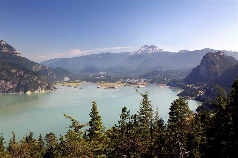
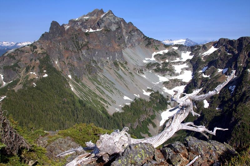
Earlier this year camshaft reprimanded me for labeling Petgill Lake rather lame destination. I wanted to check out the area again, suspecting this is one of these places you have to go higher to gain full appreciation. My destination was long alpine plateau that extends itself in direction of Sky Pilot group, also known as 'Goat Ridge'. It is visible as long snowy line in upper right part of this photo, taken from 3rd Chief earlier in the spring:

There is not much detail about this hike on CT, so I will give a bit more info. I started off Murrin Park parking lot at 9:30 am. In retrospect this was too late -- 8 am would have been optimal. Not much to say about first part to Petgill Lake; I made only 1 brief detour for photo of Squamish from bluff roughly 30 minutes into the hike:
Arriving at the lake I first made a brief detour. Group of Asians were packing up the camp (they also made huge mess; I hope they cleaned it up). There was also a (Polish ?) fellow drinking beer (11:30 am) and reading Straight. We chatted a bit; he told me he was going to Deeks Lake, but couldn't find the parking lot, so he ended up at Petgill [:0]. Few photos of the lake:


Then it was Goat time! I wasn't sure what to expect; I knew it was going to be steep, and that North Shore Hikers do this on semi-regular basis, but not much beyond that. Start of the Trail is impossible to miss -- it branches right (east) few minutes before the lake, with metal marker on the tree indicating direction. It drops down a bit, crosses wet marsh, then starts going up. Now for the interesting part: There are good and bad news. Good news: Trail is superbly marked, abundant flags and frequent tapes and red paint on rock:

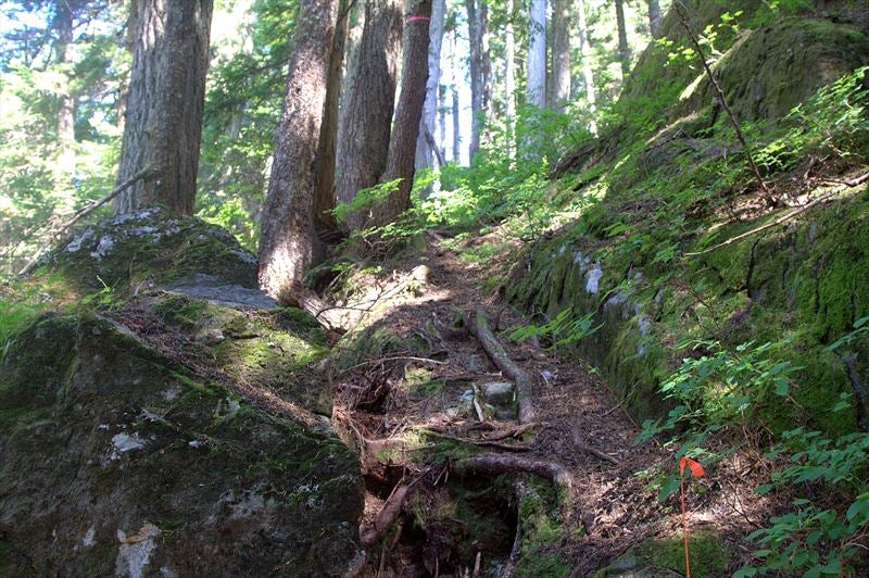
Both of these photos were taken in lower part of the trail -- up a draw, traverse to bypass a cliff, move back. Footbed is quite distinct and in summer conditions when snow has melted it would be very hard to get lost.
Now for bad news: This relatively easy part abruptly comes to a halt about halfway up. More or less straight up, over deadfall and brutally steep. Still well-flagged, never really dangerous but very unpleasant (specially climbing down -- leave lots of time). Misery loves company -- black flies came in full force about here and I had to spray myself. This all culminated at 4-5 meter high bluff, about 70% incline that had a rope I was grateful for going down:

It is about 600 vertical and 1 1/2 hr minimum from Petgill Lake to this point for most people. But now the worst is over: Incline moderates, things start opening up and in another 10-15 minutes you enter one of most beautiful sub-alpine areas I've seen so far in BC Coast. Series of tarns, one more beautiful than the other, each begging for the dip:


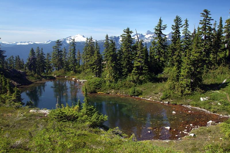
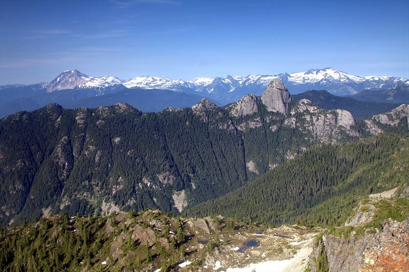
It would be well worth hauling overnight gear (and a 6-pack) up to here. From now on everything was so incredibly beautiful. I hiked with camera around my neck, and took over 3 hours for what was only 1 hr 15 on descent. Views west started opening up with Tantalus and Garibaldi group dominating the horizon:


Still wonderfully flagged, trail climbs more steeply towards first highpoint on the ridge. Black flies were also gone, making this part sheer joy. Couple of snow patches were still there covering the trail, but terrain is open and you can generally make your own way. Small bodies of water fill granite fissures, competing for camera time:


Always going in easterly direction, trail moves briefly to the left granting northerly views of strange phallic object. Is it Mt. Habrich, or just an oversized Chief [

]?

Then the moment I was waiting for comes in: My first close-up-and-personal meeting with Sky Pilot group! This was easily the most scenic part of the trip; at moments like this I forget how tired I start to feel, I forget mosquitoes that started swarming around me, I forget lactic acid that started building up in my muscles after 1700 or so of vertical elevation gain; I am just elated to be alive, on such a wonderful place I have to myself, at least for couple of hours:


Flags are now scarce and trail frequently disappears, but this is of no importance. I could see the highpoint of the ridge and my final destination; it was still about 40 minutes from this point, as there were couple of shallow notches to cross. One of them required brief somewhat scrambly downclimb down the ledge, but I possibly did not choose the easiest path. Trail again re-appears just before the final part; brief climb up the scree, then 5 minute walk along grassy ridge to 1710 m high summit cairn:


1. Copilot from Goat Ridge Higpoint.
2. View towards Squamish. Ants on Chief are somewhere down to the left
3. Nice shot of Mt. Habrich with Garibaldi Group on the horizon. This photo was taken from little sub-summit, few minutes to the north. Notice couple of nice looking tarns down there.
4. One more self-timed shot with Copilot
5. Panoramic views north and east from Goat Ridge Highpoint
Knowing some folks are curious about accessing Sky Pilot from Goat Ridge, before turning back I looked down first big promising gully: One glance was enough. Anything is possible I guess, but I'd not be going up or down that way.
It was now 6:30 pm; I had about 2 hours before sunset. I had to hassle as I wanted to get down to Petgill Lake before dark. Lower down in Lake District I ran into this:

This sucker caused me to waste 1/2 hour. Absent-minded I followed the path arrow pointed to; environment started looking unfamiliar and flags stopped. I realized something was wrong and backtracked, then re-assumed on path I came up. This arrow is for snowmobile -- I have no clue where it eventually ends up (If someone does, please let me know).
Coming down was brutal. I was tired and every step was an effort; mental in particular as I needed to focus in order to come down safe in upper part. Dark caught me just bellow Petgill Lake; it was an interesting experience hiking out last 1 1/2 hours with headlamp -- I was glad for that spring trip as I was more familiar with overall direction. I emerged back to the parking lot at 10:30 pm -- round trip of 13 hours. Realistic time is probably 11, but I need to hike without camera for that.
GPS map of route from Petgill Lake to Highpoint of Goat Ridge:

At the end, how do I feel about Petgill now? I still think lake itself is best done as shoulder season trip only, when other things are not feasible anymore because of snow. Goat ridge trail is not for everyone; I understand now why many people fail in late spring or early summer, when flags that are pretty much necessary for right direction higher up are covered by snow. But the Goat alpine, Tarns and ridge traverse is something I will recommend to anyone that has enough juice to get up there for a long time after I have moved from lower Mainland.
One last thing: coming down from the ridge, about 1/2 hour before Petgill Lake, someone lost (prescription) eye glasses. They were still in the fold. Please contact me if they are yours.

 Your Privacy Choices