Note: I'm still adjusting to kilometres and metres, my apologies for all the “mileage” and “feet” contained herein! I like it when guidebooks have both measuring systems. The Canadians with us kept asking, "So what's this distance in
real terms?"
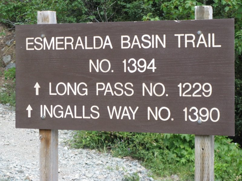
This past weekend I was planning to take a few friends for an overnighter at Hannegan Pass, in the Mt. Baker vicinity. Not wanting to venture into bad weather, we ended up doing the Esmeralda Loop in the Wenatchee National Forest, near the Alpine Lakes Wilderness in Washington (the Enchantments are a few mountains away to the north and east). There were other trails in the relatively dry region of the Teanaway that looked somewhat nicer, but since we had neophytes and some injuries, we went with the one with lower elevation gain (approx. 2800' over the two days) and no steep climbs.
The 100 Classic Hikes in Washington book said that the loop was 15 miles, but the Green Trails map (Mt. Stuart, map 209) marked it at about 13; it felt more like 13.
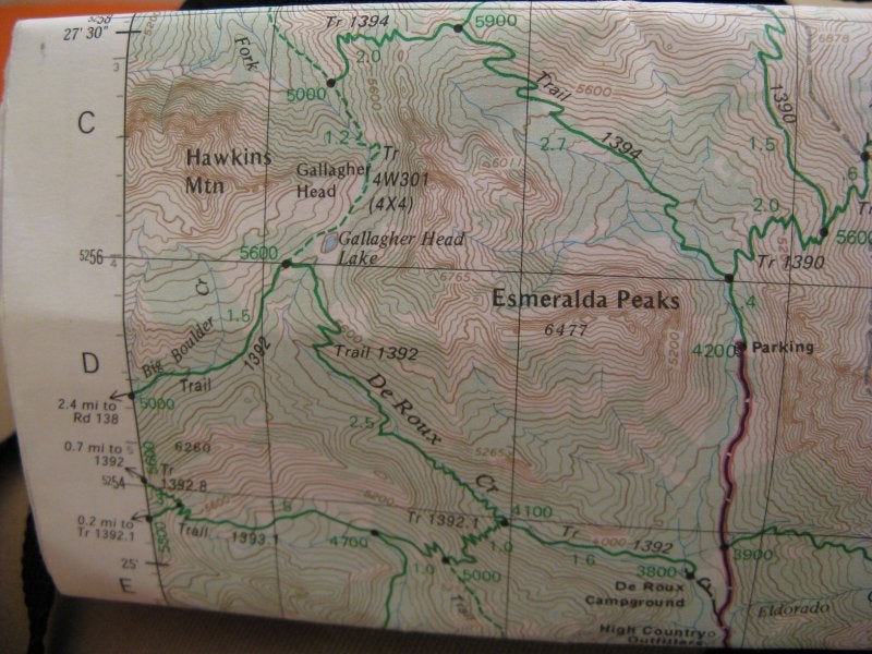
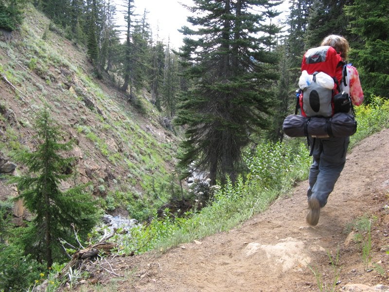
Driving over 25 miles on the North Fork Teanaway Rd, from Hwy 970 and the town of Cle Elum, we parked at the end of the road. We headed up through forest for about a mile or so before wonderful views began to appear in the Esmeralda Basin. We kept climbing to incredibly scenic Fortune Creek Pass, passing a trail to Lake Ann (another time, hopefully). There was a wonderful campsite at the Pass, but it was too windy for us.
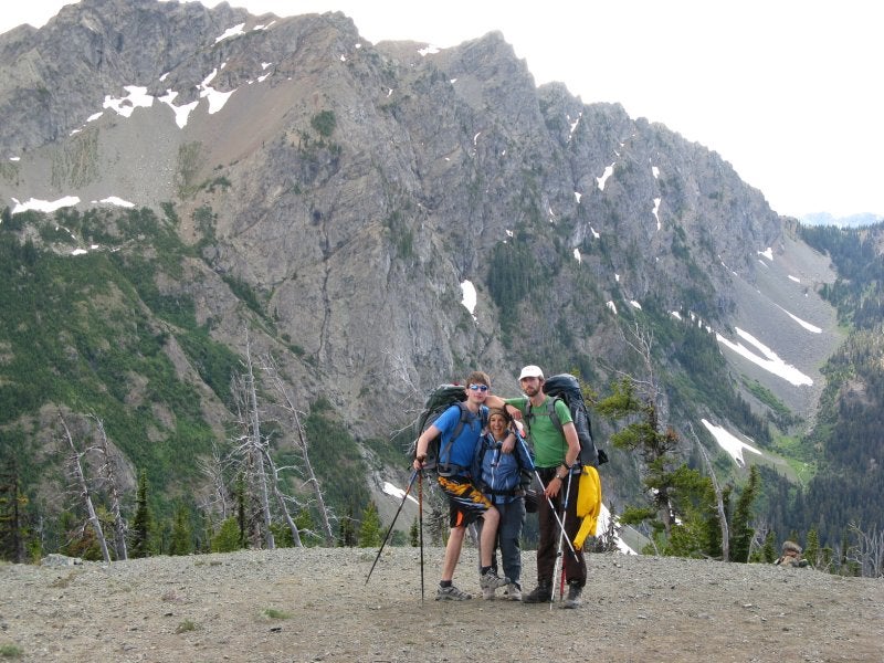
at Fortune Creek Pass
We were two short women hiking with two very tall men!
After the pass we headed steeply downhill until hitting a jeep road en route to Gallagher Head Lake; the road gaining about 500' to the lake. This shallow lake is in a beautiful setting, but because of a number of car campers we skirted the area as quickly as possible. We met a couple who were wearing identical hats with large-sized letters reading “ORV” whom we asked directions for the continuation of the trail. They pointed back towards their camp where at least ten other people were barbequeing and said, “It's back that way, go ahead and go through the camp, they won't mind.” And they shouldn't have, seeing as how their camp was ON the trail! We didn't even stop to take any pictures of this pretty lake.
And down again we went on trail 1392 (Washington has a great trail numbering system). I was beginning to worry that we wouldn't find any campsites, but just as we hit a flat meadow we found a perfect site: lots of room for two tents, near a creek, no bugs, with a fire ring and plenty of downed, dry wood. Ahhh. A little slice of heaven.
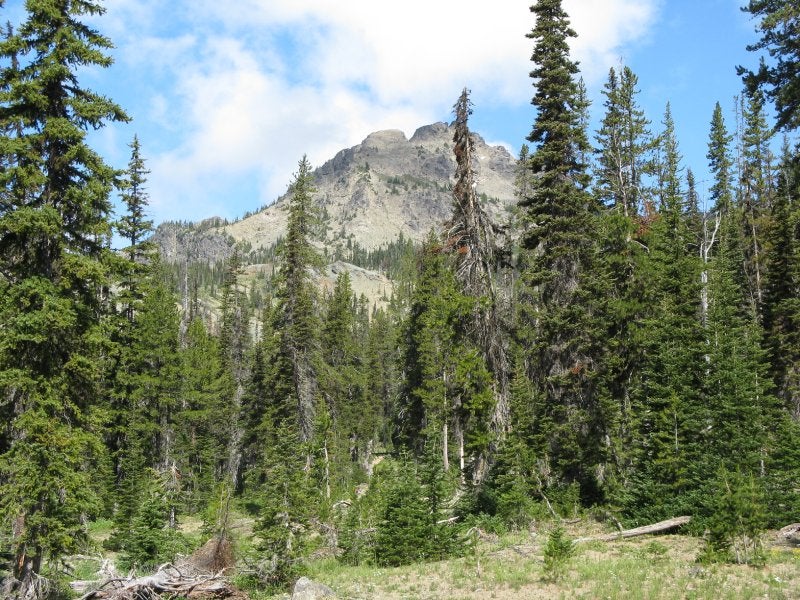

We woke the next morning to sunshine and a leisurely breakfast. Shortly after the meadows we descended down a gully with great waterfalls on our right and a few miles later we were at the abandoned De Roux Campground. At least the books say it's abandoned. It's actually quite active with horse folk using it. A horse camp is near here – oh, did I mention this is an equestrian trail? Lots of horse poo and the occasional horse train are encountered on this loop.
descending by the waterfall
It was a mile and a half back to the parking area, but we were able to drop packs at the campground and stroll to the car.
I highly recommend the Esmeralda Basin Loop, especially for newer backpackers due to its low elevation gain and great variety of terrain, views, wildflowers, and much dryer weather. Drawbacks, though, are walking on roads, horses (and their leftovers), and the 4x4 people at the lake.
When I have the chance to go back, I'd like to get to Lake Ingalls, as well as Navajo Pass. Last year in June I did an overnighter with friends on Ingalls Creek (just south of the Enchantments – also amazing country), which was wonderful for early season backpacking. This is simply a great region.


 Esmeralda Basin Loop, Aug 1-2


 Your Privacy Choices