hi everyone,
i thought about adding this trip, which was done 4 years ago, to the trip report. this was a great opportunity to show everyone the trail that i have planned for this coming september.the loop is around 160 miles which starts at rainy pass.
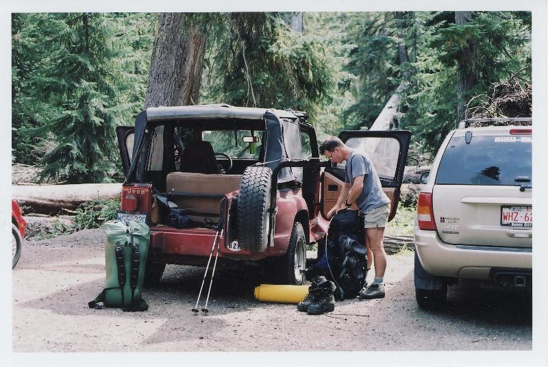
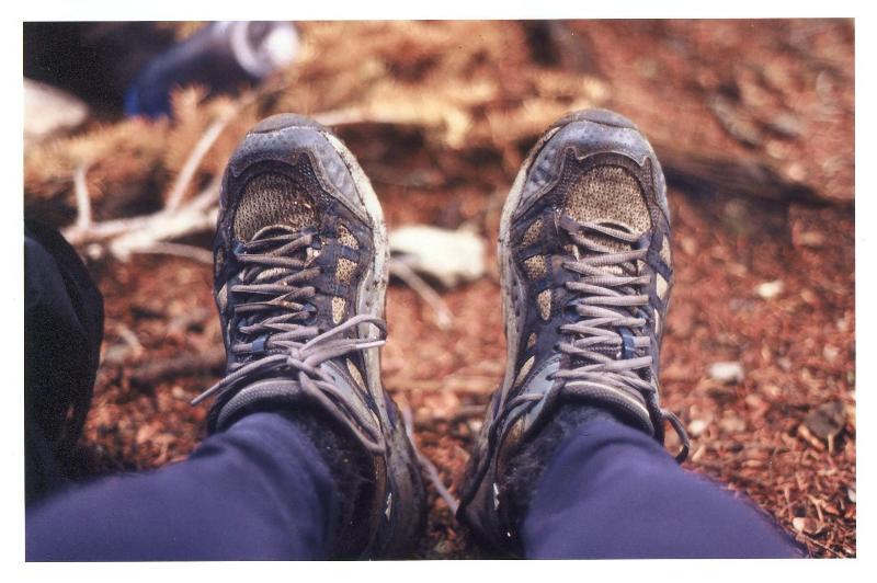
james and i left vancouver for the us border at 6 am. luckily there were no delays at the border and we got through no problem. i exited interstate 5 at the junction for highway 20. this would lead us to marblemount where we had to obtain our permit. the permit was good for the campsites that were within the park boundary.
day 1
rainy pass to north fork camp 12 miles
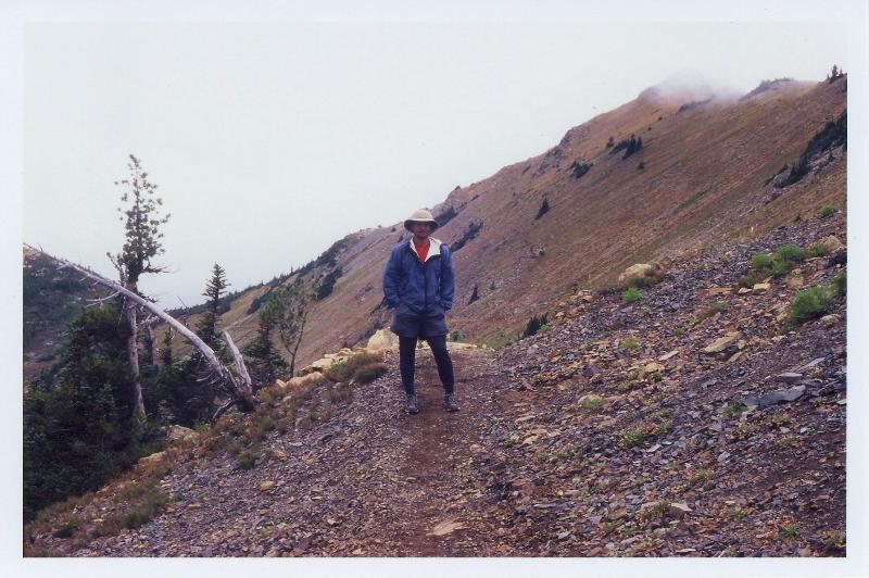
we arrived at rainy pass at around 12:30 pm. it was my first time in these parts and i found the drive in very scenic. we didn't get on the trail until 2. the weather was excellent and the trail conditions were great on the pacific crest trail. it was downhill all the way to our first campsite at north fork. we arrived at camp at 8 pm.
day 2 north fork camp to thunder basin 15.7 miles
woke up late therefore late start. the weather was nice and so was the trail.


it was an easy descent 1.7 mile from berry creek to stehekin road. we followed the road for 2.5 miles and stopped for lunch at the park pass trailhead. it was going to be an 8 mile ascent from here to the pass. as we started the to climb to 2 mile camp i started to feel weak. i guess it was those damn pepperoni sticks that i ate. all the fat was making me feel sluggish. i let james take the lead. after 2 mile camp, i started to feel better. we stopped for a break and i could see the weather starting to deteriorate.


it was a gentle climb to 5 mile camp where we stopped for another break. as we started to head for the pass, it started to rain. it was still warm for me so i opted to keep the jacket in the pack. the trail started to get bushy as we were approaching the meadows. there were a lot of bear droppings on the trail.

the trail hadn't stopped climbing and the rain kept coming down. i was starting to feel cold and tired. the wind had picked up as we switchbacked through the meadows. finally reached the pass and it was short and sweet. i was looking forward to getting to camp to make dinner.


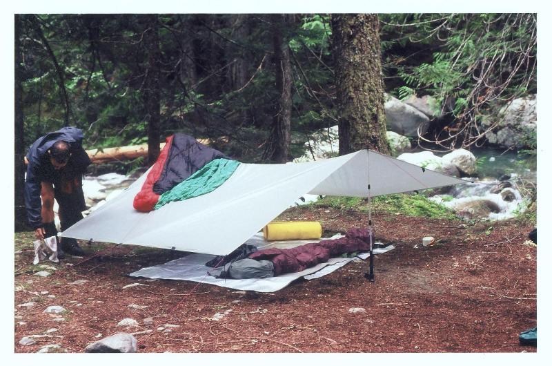
we started our steep descent to thunder basin. now comes the start of thunder creek trail. my legs were getting sore as we switchbacked steeply all the way to thunder basin camp. we still made a lot of noise all the way after seeing that bear close to the pass. when we reached our campsite, we quickly set up the tarp before the rain started again. it was nice to get into dry, warm clothes. the only complaint i had of this campsite was that there was no way to hang the food. we had to store it under the tarp.
day 3 thunder basin to mcallister creek camp 9.5 miles


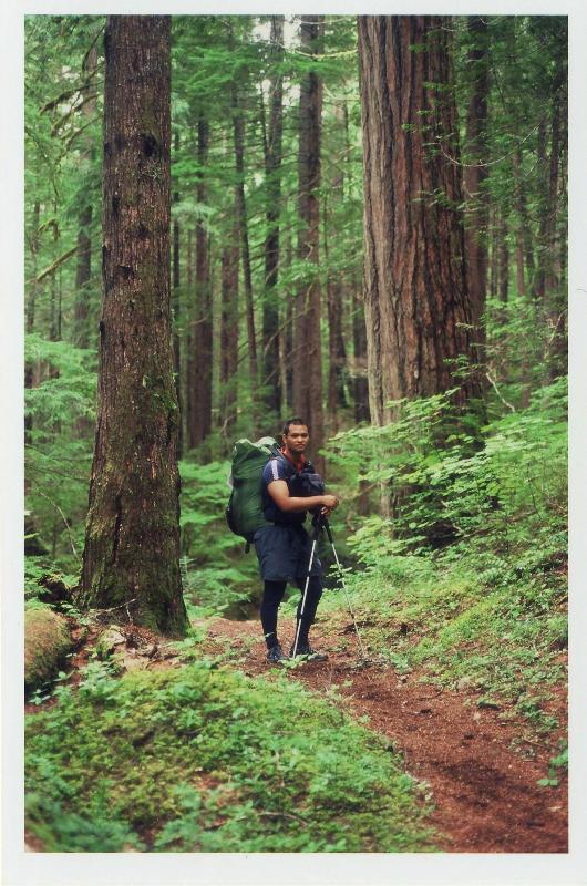
it was a wet and noisy night. we woke up 2 am to lower the tarp and retighten the guylines because the wind and rain had picked up. at least it had stopped raining when we both hesitantly woke up at 8 am. i got changed into my wet clothes. brrrr. we started our descent to mcallister camp at 9:30. the trail was still bushy and covered in moisture. it didn't take long to get wet all over again. beautiful view of the valley on the way down to skagit queen camp. unfortunately, my camera was fogged up so i couldn't take anymore photos. eventually we got into the open forest but the trail still was pounding my sore knees. after skagit queen the trail rose to junction and then another steep descent to tricouni camp.
we got to the river crossing after tricouni. james scouted for the safest place to cross. it looked to be a dead end. the creek was moving too fast for a safe crossing. after several minutes of looking, james found a log jam to use to get across. once across we had a bit of a problem looking for the main trail. we scouted for a trail close to the river and it looked to be going nowhere. we went back to the crossing and there it was. i didn't see the flagging tape that was hanging on a branch. then it was home free to mcallister camp where we stayed at the horse camp.
day 4 mcallister creek camp to panther creek camp 9.5 miles
we broke camp at 8:30 and soon we were on our way to the next campsite at panther creek

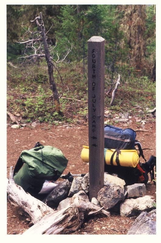
we were moving at a good pace down the easy trail until we got to the climb for the fourth of july campsite. it was steep. we stopped for lunch at the campsite. there was a short climb up to the pass and then switchbacks down to a straight descent through more bushy trail to panther creek.
we set up camp quickly then we scouted for the trail. the rangers at marblemount had warned us of a possible bushwack after panther creek camp. we noticed a trail across the creek so we decided to do that instead. there were 2 thick log to get across on.
day 5 panther creek camp to devil's creek camp 15 miles
the rain greeted us this morning. i was hoping that it would have stayed dry long enough for the crossing. i wasn't too thrilled about slippery logs to cross on. it was going to be a big day today as our route was to connect with jackita ridge/ devil's dome trail. the 3 mile trail from panther creek to highway 20 was straight forward. we stopped for a wet lunch by the highway and discussed our options on either to keep going to jackita ridge or stay low along ross lake. the rain hadn't let up and the winds had picked up again.
i didn't think that we would enjoy the hike up in this crappy weather so we went for the east bank trail along ross lake.
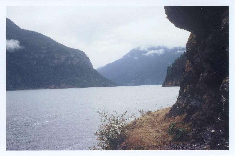
the trail was fairly flat and had nice views of the lake. the rain had stopped until we got to devil's creek camp. then it came down again. the mosquitoes were bad here. both of us started to bathe in bug dope. poor james had numerous bites on his legs.
day 6


today is rest day since we were ahead in our schedule. it had rained all night and still it hadn't stopped. looked like we made the right choice to stay low. i just spent the whole day in my sleeping bag writing, reading , eating and sleeping. james was getting claustrophobic and braved the weather spending most of the his time away from the tarp. at least the bugs weren't bad today. during dinner, james' stove died on him. he had damaged the fuel line on his msr whisperlite. looked like another detour in the trip. we decided to cancel three fools/ elbow basin and head up to camp at devil's pass so that we could connect faster to the pacific crest trail. all we had to do was follow the trail up to devil's dome. i just hoped that i had enough fuel for the both of us.
day 7 devil's creek camp to devil's pass shelter 13 miles
i could hear light rain as it hit the tarp. i didn't think the weather was too bad today compared to the last 2 days. we got going at 8:30. the trail up to devil's dome started to climb once we left camp. it had stopped sprinkling but my feet were soaked by the shrubs that had collected the morning rain. we met a pct thru hiker on his way back to canada coming down the trail. he told us of the stormy night that he had spent at devil's shelter. i was glad we spent the night down low.


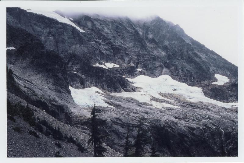
the forest was starting to open up as we got higher and higher. even the sky started to get brighter. even though we were gaining elevation, the temperature seemed to get warmer. soon we were getting views of jack maountain. well kind've. when we reached bear skull shelter, the clouds were starting to break a little.


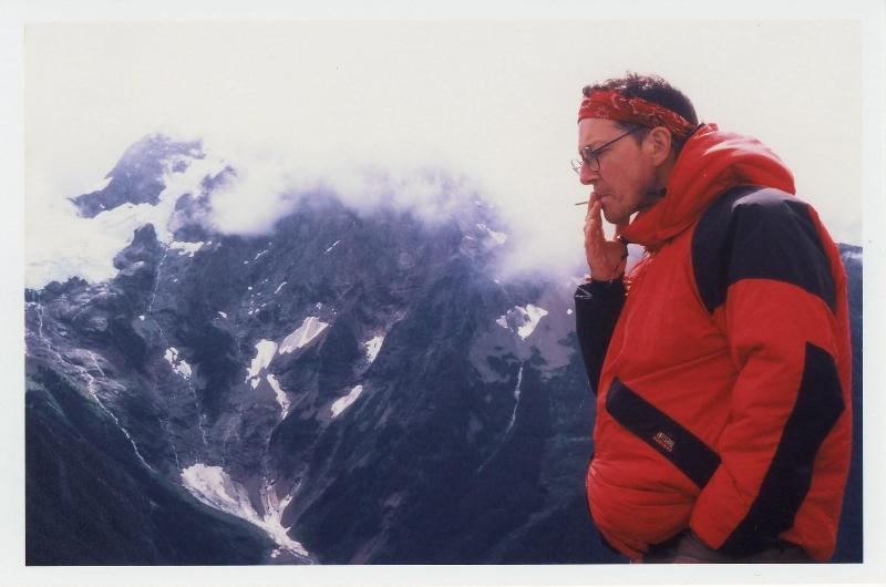
we stopped for a break at the top of devil's peak. the views were spectacular considering there were clouds blocking the views of jack mountain to the south of us. the climb to the top wasn't as steep as the last 5 miles. at least the weather was cooperating for once. i found it chilly up here with the wind so we descended the trail half a mile down to get out of the chilly breeze and break for lunch.


it was easy hiking all the way to the junction for devil's pass and jackita ridge. we did spend some time looking for the shelter that was suppose to be at devil's pass. when we couldn't find it there, we went along the jackita ridge trail to look for it. we turned back when that didn't work out. we did find a campsite by a decrepit structure half a mile down past the junction. along the way to the campsite , we spotted another bear. we watch for several minutes as the bear dilly-dallied up the slope.

day 8 devil's pass shelter to foggy pass ? miles
holman pass to foggy pass 6.4 miles


woke up at 6 am to the sound of no rain. but it was still overcast.it turned out this was devil's pass shelter and the broken down structure was the shelter. we got going at 8 am to connect with the pacific crest trail at holman pass. it was easy hiking again to deception pass but i lost my cool at sky pilot pass because my feet were still getting soaked by the wet brush i had to walk through. i thought to myself that it was impossible to stay dry. after a brief temper tantrum, i had to laugh at myself and i just accepted that this was part of the trip. we could see holman pass as we were descending the trail from sky pilot pass.

we passed a couple of campsites then we were at holman pass. we stopped for a short break before heading for windy pass. the trail was nice and wide. no more wet feet from now on.
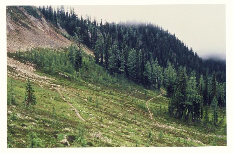
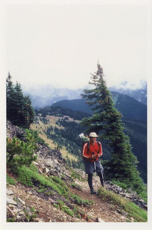
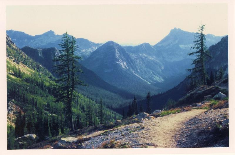
i'm lovin this trail. easy grades, wide, well maintained. there were wonderful views of gold ridge and pasayten peak to the east of us as we made our way to foggy pass and then to camp at before windy pass.
day 9

foggy pass to horse heaven camp 22 miles
well we were a couple of miles short of our objective due to confusion in reading the contour lines on our topo map. we thought we had reached windy pass when in fact we camp just after foggy. oh well, we'll just have to add another 2 miles to our hike.
the weather again was grey. still no chance for sunshine or views along the way. the clouds seem to be low when we reached foggy pass. the trail was really nice. easy grades up and down. even though we couldn't see the peaks all around us, the views that we could see were just spectacular. we descended into a basin where there was a water source. after filling up the bottles. we headed up to windy pass.
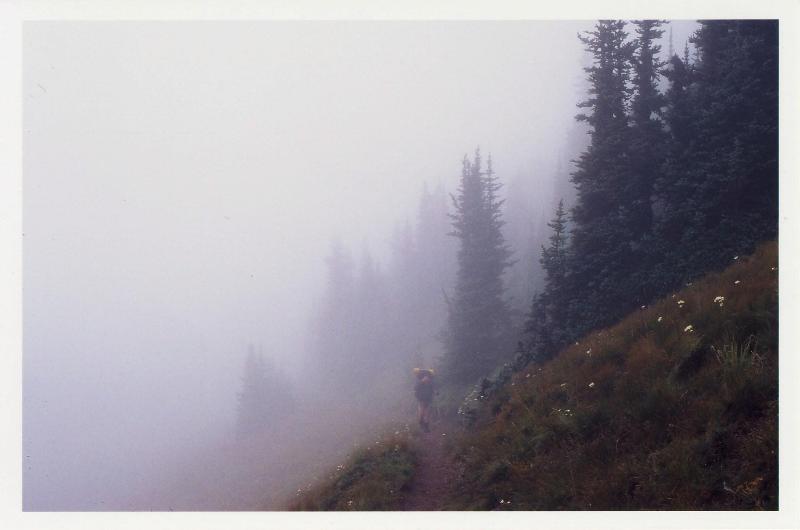
by the time we reached buffalo pass we were in thick fog all the way to slate pass. eventually we dropped elevation and it was nice to get out of the fog. we soon head for harts pass. our trail switchback up and down and soon we could see harts pass.

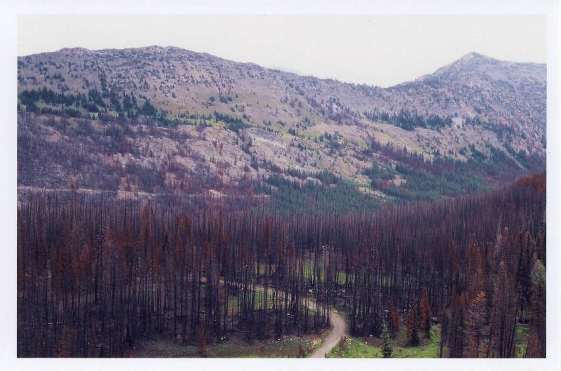
harts pass was an interesting place. there was a car camping spot close by. the unfortunate thing was that there were no water sources here. out trail cut through the old burn section. it still had that smoky scent in the air. the pct was rerouted through this section because of the forest fires that occurred here. back at slate pass, there was a notice that glacier pass to cutthroat was closed off due to the fires. it was posted a while ago so we risked going on to glacier pass. hopefully it would be open.
i didn't want to reroute again.
anyway, we made our way up to glacier pass. we ran into a thru hiker before then and he warned us that there wasn't any water source for the next 10 miles. just great, i just finished my bottle back at slate pass. for once i was appreciative that the weather wasn't sunny and hot or i would have been in big trouble.
it was a beautiful trail up to glacier pass. there was a water source in a basin just below the pass but i was too tired to lose all that elevation so i kept on going, knowing that there was water at brush creek. the trail was pretty much up and down with a lot of switchbacks in between each pass. we knew that we were close to brush creek because we could hear the water. the area around brush creek made james feel uneasy. there was dense brush everywhere. james made a lot of noise here. our trail was beside brush creek but i couldn't get to the creek because the vegetation was thick. too much work to fill my bottles. i knew we were close to the river crossing.
when we reached the river, it was heaven to drink again. i treated the water quickly because it was starting to get dark and we still had a couple of miles to go. dark had finally got us and we were in the forest. i pulled out my single led light and it was sufficient to navigate on the trail but it wasn't enough to look for the campsite. so we just crashed by a nice creek close to the trail. there were nice cushy twigs that i set the ground sheet on and it made for a wonderful sleep.
day 10 horse heaven camp to rainy pass 17 miles
woke up to no rain for once. we knew that we had a short day to golden horn so we weren't rushed to get going. after hiking a few hundred yards, we spotted horse heaven camp. we were quite close to it. i wasn't upset at all because we had a nice creek beside us. the trail seemed flat most of the way to golden horn. minor elevation gains. the sun had finally come out to show us what we missed for scenary. i thought the timing was just right because the mountain views were breathtaking here all the way to the car.


when we arrived at snowy lakes, james and i decided to keep on going to the car so we still had methow pass, granite pass and cutthroat pass to get to before the 5 mile descent to rainy pass. we reached the car with the last bit of light trickling away.


 north cascade loop august 2004


 ! Trip to remember for sure [8D]. Thanks for posting

 Your Privacy Choices