Slalok Mnt.(Rex's Pillar) North face June 11, 2011 - ClubTread Community

User Tag List

 
LinkBack Thread Tools
post #1 of (permalink) Old 06-12-2011, 12:09 PM Thread Starter
High on the Mountain Top
 
Join Date: Jun 2006
Location: , , .
Posts: 1,356
Default Slalok Mnt.(Rex's Pillar) North face June 11, 2011

Yesterday, Marjan and I climbed North face of Slalok Mountain.
Here is the information about the mountain from bivouac.com

Slalok Mountain (Rex's Pillar)
Height: 2653 m (8704 ft)

Slalok, East Face
Located above upper Joffre Lake. Slalok is a glaciated summit above Upper Joffre Lake. The most popular route seems to be up the Stonecrop Glacier, particularly on the far right side. The rocky summit provides pleasant views.
Name Notes: This peak was originally called Rex's Pillar, until the massive renaming of the 1990's.

1. East face 45 degree snow. Normal winter route. Approach by Anniversary Glacier and Matier Glacier to the base of the East Face at NAD27 382-753 on 92 J/8. Ascend snow face between two rock bands to summit plateau (45 degree). Continue to true summit to the south watching for crevasse.
2. Slalok - North face Good ice route in summer. Approach by Joffre Lake Trail. Ascend Stonecrop Glacier to bottom of face as crevasses permit (snow/ice to 45 degree). The face offers 3 pitches of ice/snow to 50 degree. Top out on summit plateau just north of true summit. Descend by the Southwest Ridge.
3. Southwest Ridge Pleasant scramble.. Normal summer route
Approach by the Joffre Lake Trail. Continue past the Upper Joffre Lake up the Tszil Valley. Gain the Tszil-Slalok pass by ascending the Tszil Glacier. Alternatively, gain Tszil-Slalok pass by crossing over Mount Tszil from the Taylor-Tzsil col (this slight detour for nervous soloists avoids the crevassed Tszil glacier). Start ascending the Southwest Ridge by scrambling easy ledges to bottom of cliff. Scramble up cliff to false summit using a line to the far right (good rock and plenty of holds with little exposure). Continue along narrow ridge on good rock or snow. One more short scramble to pass a high ledge is the last obstacle before the summit.

We left Vancouver last Friday at 11:00 PM
Slalok mountain was a plan B. The initial plan was to climb NW face of Mt. Matier, but we wasn't able to ford the high water of Cerise creek. The summer trail was still covered by snow. We decided not to try it, because both of us never have been on this trail before. We didn't wanna search for the route in complete dark. It was just about 2:00 AM. We drove back to the Joffre lake parking.
The snow was right away from the parking lot. In the dark it was difficult to follow the trail to Joffre lake, because it still was covered by snow. We started our ascent of North face slightly after 6:00AM. The weather was warm and overcast, thick clouds and a complete whiteout on the glacier. The snow was really soft, the postholing was severe almost all the way. We summited at 11:20 AM. The whole trip took almost 14 hours and sucked a lot of energy from both of us. We were back at the car by 4:00PM. In the end it was a good day in the mountains. Thanks Marjan for driving and leading the trip.[8D]
Here is a few pictures from the trip. Also you can find some extra pictures from Marjan's link https://picasaweb.google.com/marjanc67/SlalokJun2011
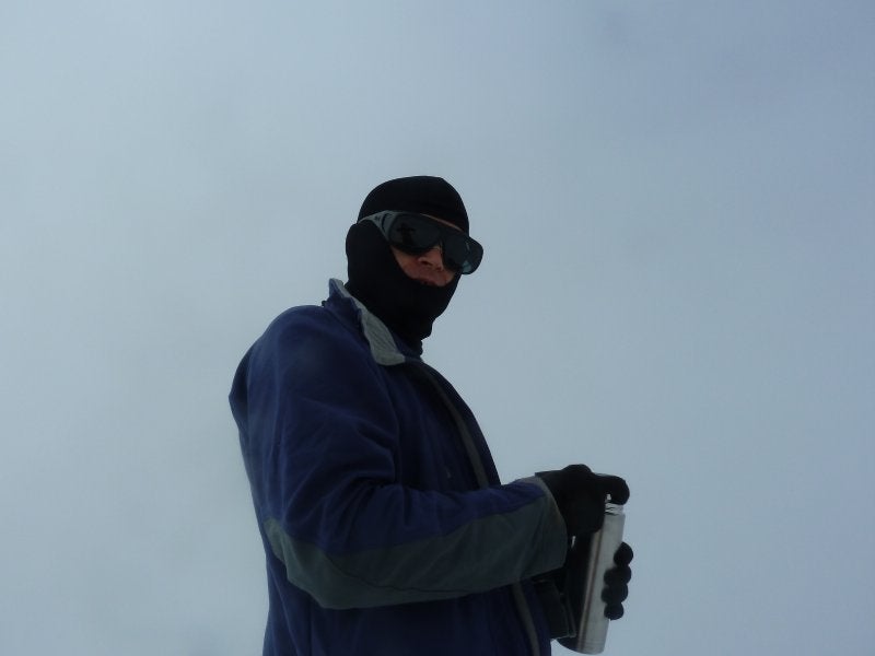


Going up.


1. We just finished climbing the gully. At the bottom of Stonecrop glacier. Frozen Joffre lake below.

A few summit pictures


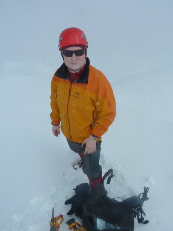
1.-2. Marjan at the summit.
3. Our tracks
4. A huge snow cornice of a subsummit.
5. Nikolai at the summit.


Going down

1. A huge avalanche debris.
2. Marjan finished downclimbing. Joffre lake below

Slalok is done. A few pictures from the Joffre lake area.

1. Our route.
2. Tszil (left) - Taylor (right) col.
3. Joffre lake.
4. Nikolai and North Face of Slalok mountain.


Our GPS tracks
nortonchum is offline  
Quote
Sponsored Links
Advertisement
 
post #2 of (permalink) Old 06-12-2011, 06:15 PM
Off the Beaten Path
 
Join Date: Aug 2009
Location: , , .
Posts: 889
Default

Good job!

"The postholing was severe almost all the way", yet I see no evidence of your roping up on the glacier. [?]
RamblingBull is offline  
post #3 of (permalink) Old 06-12-2011, 06:38 PM Thread Starter
High on the Mountain Top
 
Join Date: Jun 2006
Location: , , .
Posts: 1,356
Default

Quote:
quote:Originally posted by RamblingBull

Good job!

"The postholing was severe almost all the way", yet I see no evidence of your roping up on the glacier. [?]
The amount of snow was so unbelievebly huge for this time of the year, so after the brief discussion we decided to leave our harnesses and some ice climbing gear at the lake. However, I carried a rope and a couple of biners in my pack all the way. But, like I said the amount of snow was so big we never felt we really need a rope.
nortonchum is offline  
Sponsored Links
Advertisement
 
post #4 of (permalink) Old 06-12-2011, 07:30 PM
Summit Master
 
LeeL's Avatar
 
Join Date: Mar 2005
Location: , , Canada.
Posts: 2,669
Default

There's almost 6m of snow still at 2100m per snow plots so nortonchum's assessment was bang on.

Still looks very skiable
LeeL is offline  
post #5 of (permalink) Old 06-12-2011, 07:37 PM
Summit Master
 
Ryan.in.yaletown's Avatar
 
Join Date: May 2008
Location: Van, BC, Canada.
Posts: 3,230
Default

Quote:
quote:Originally posted by LeeL

There's almost 6m of snow still at 2100m per snow plots so nortonchum's assessment was bang on.

Still looks very skiable
You have any websites for such stats, or going off of first hand reports?

-Ryan
Ryan.in.yaletown is offline  
post #6 of (permalink) Old 06-12-2011, 07:56 PM
Summit Master
 
LeeL's Avatar
 
Join Date: Mar 2005
Location: , , Canada.
Posts: 2,669
Default

Snow pillow data from govt sites not accessible to public unfortunately at this time. I don't have access but get periodic reports with lots of !!!!! due to record high pack.

FYI Matt Gunn's site has a link for publicly accessible snow pillow data remote sites.
LeeL is offline  
post #7 of (permalink) Old 06-13-2011, 09:44 AM
Summit Master
 
Join Date: Jul 2004
Location: Vancouver BC
Interest: 10%
Posts: 5,022
Default

Good trip gentlemen. You guys have spent a lot of quality time in that area.
simonc is offline  
post #8 of (permalink) Old 06-13-2011, 10:15 AM
Dru
Super Moderator
 
Join Date: Aug 2004
Location: Climbing, a mountain, Canada.
Interest: climbing and spraying
Posts: 16,172
Default

Quote:
quote:Originally posted by LeeL

Snow pillow data from govt sites not accessible to public unfortunately at this time.
http://bcrfc.env.gov.bc.ca/data/asp/realtime/index.htm
Dru is offline  
post #9 of (permalink) Old 06-13-2011, 09:45 PM
Off the Beaten Path
 
Join Date: Sep 2006
Location: Edmonton, AB, Canada.
Interest: Bumming around above treeline.
Posts: 773
Default

Great trip Nikolai, very detailed report too! too bad about the clouds!

Benoit
gyppo is offline  
post #10 of (permalink) Old 06-14-2011, 06:38 AM
DPM
Off the Beaten Path
 
Join Date: Sep 2009
Location: Vancouver, British Columbia, Canada.
Posts: 630
Default

Nice work and good perseverance!

Sounds like the postholing was worse on your side of the Joffre group - on the Cerise Creek side we did use snowshoes until just past Keith's Hut, and then crampons above that point - penetration was pretty minimal in the early morning, and about ankle- to mid-calf deep by the afternoon.
DPM is offline  
post #11 of (permalink) Old 06-12-2017, 04:20 PM
Scaling New Heights
 
Join Date: Mar 2009
Location: Vancouver, Canada
Interest: Anything outside...
Posts: 77
Default

Could I have the GPS tracks for your route? Looks good!
stever is offline  
Reply

Thread Tools
Show Printable Version Show Printable Version
Email this Page Email this Page


Posting Rules  
You may not post new threads
You may not post replies
You may not post attachments
You may not edit your posts

BB code is On
Smilies are On
[IMG] code is On
HTML code is Off
Trackbacks are On
Pingbacks are On
Refbacks are On

 
For the best viewing experience please update your browser to Google Chrome
 

Search Engine Optimization by vBSEO 3.6.1