Fire Lookout Trail, West Pavilion - May 17, 2015 - ClubTread Community

User Tag List

 3Likes
Reply
 
LinkBack Thread Tools
post #1 of (permalink) Old 05-27-2015, 01:11 AM Thread Starter
Off the Beaten Path
 
ashi's Avatar
 
Join Date: Jul 2009
Location: Vancouver, Canada.
Interest: Exploring, hiking, scrambling
Posts: 721
Default Fire Lookout Trail, West Pavilion - May 17, 2015

Trip Date: May 17, 2015

Full Trip Report: http://www.ashikaparsad.com/2015/05/...boo-chilcotin/

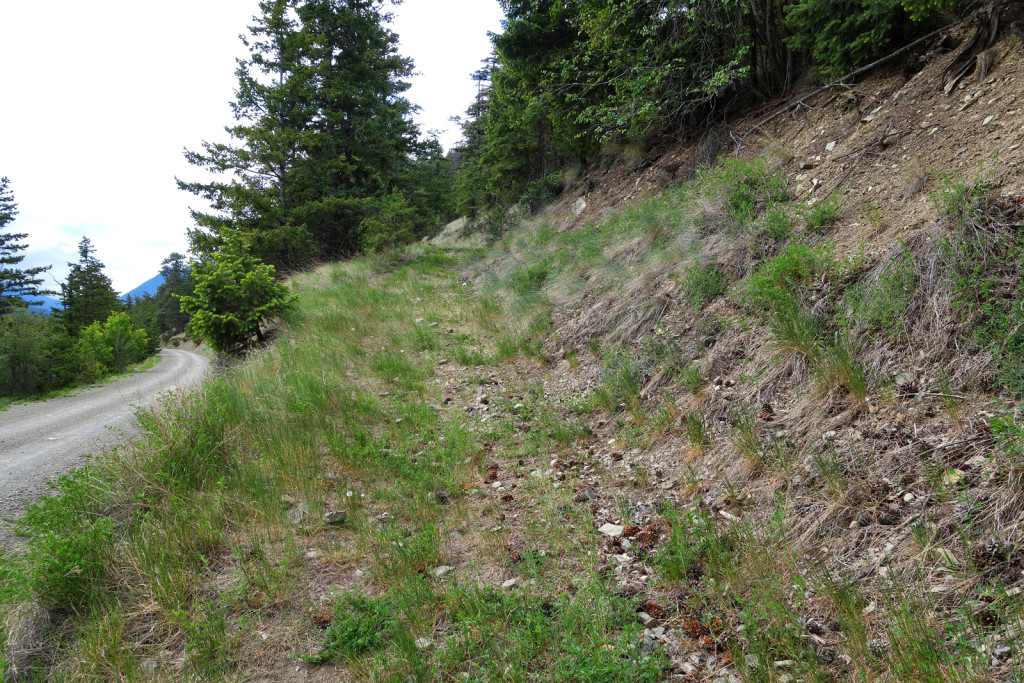
Ryan and I checked out an old fire lookout trail atop Camelshoof Peak, located at the very south end of the Camelsfoot range, near Lillooet. The fire lookout can be reached by a decommissioned service road off of the West Pavilion FSR.

Stats:

  • Total distance: 8.3km
  • Cumulative elevation gain: 481m
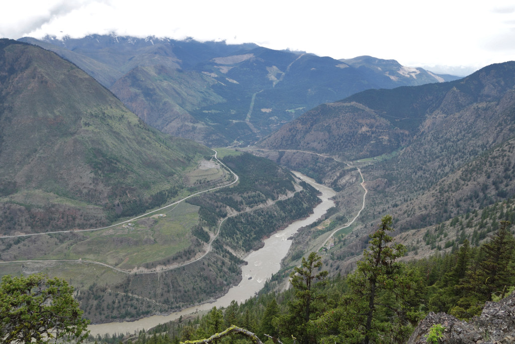
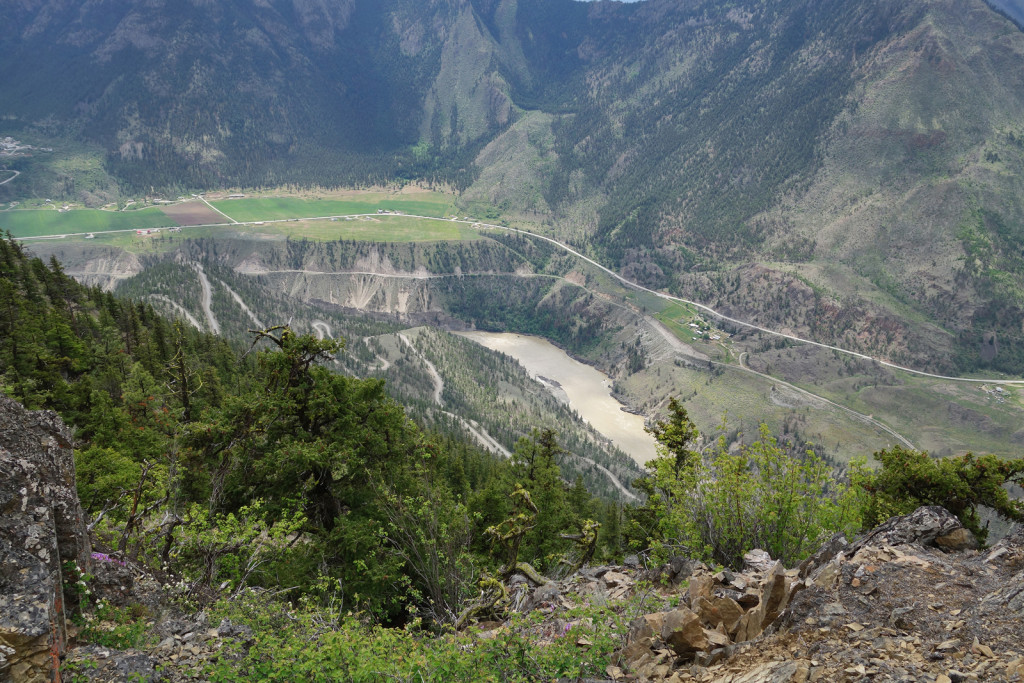
  • Panoramic views of the Fraser Canyon, Clear Range, Fountain Ridge, Mission Ridge and Mount Brew.

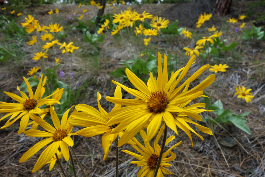
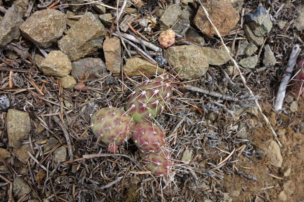
The trail follows a decommissioned road. It climbs steadily through the forest and occasional grassy areas. Wildflowers were just starting to poke out along the side of the road. Due to the desert climate, we found some interesting flora along the trail.


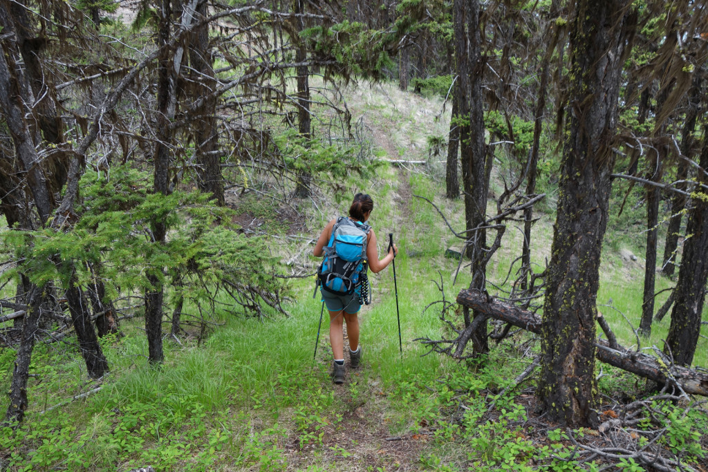
The trail continued up the ridge to the old fire lookout, officially known as Camelshoof Peak. Past the first view point, the trail steepened significantly as it climbed up and down the ridge crest. The trail was now a moderately distinct single-track, but it was still easy to follow. There were occasional views of the Fraser below.


Note: The West Pavilion area is wild country. During our drive we saw a total of 8 bears, including a sow, two cubs, and two grizzlies. If you are hiking in the area, be sure to exercise all the usual bear precautions and know what to do if you encounter bears on the trail.

History of the Area:
Camelshoof Peak and range take their name from the gold rush. In 1862, Frank Laumeister bought 23 camels from the US military. He intended to use them to carry goods on the Douglas road and Old Cariboo road from Lillooet to Fort Alexandria on the Gold Rush road. This did not last long, as the horses could not stand their smell and they had difficulty on the rocky terrain with their soft feet. They were used well into the 1870s. Many escaped into the wild. The last confirmed sighting of these ‘wild’ camels was in the Ashcroft area in ~1905, although rumours of sightings persisted into the 1930s.
ashi is offline  
Quote
Sponsored Links
Advertisement
 
post #2 of (permalink) Old 05-27-2015, 04:44 PM
Dru
Super Moderator
 
Join Date: Aug 2004
Location: Climbing, a mountain, Canada.
Interest: climbing and spraying
Posts: 16,172
Default

Quote:
officially known as Camelshoof Peak.
Nope.
Dru is offline  
post #3 of (permalink) Old 05-27-2015, 05:06 PM
Hittin' the Trails
 
Join Date: Jan 2014
Location: Cloverdale, British Columbia, Canada.
Posts: 24
Default

Might have to try that one this weekend as we are heading up to pavilion this coming weekend. Would be nice to see some bears as well.
Moe.JKU is offline  
Sponsored Links
Advertisement
 
post #4 of (permalink) Old 05-27-2015, 05:49 PM Thread Starter
Off the Beaten Path
 
ashi's Avatar
 
Join Date: Jul 2009
Location: Vancouver, Canada.
Interest: Exploring, hiking, scrambling
Posts: 721
Default

Quote:
Originally Posted by Dru View Post
Nope.

Dru, found it in bivouac, assumed it was official?
ashi is offline  
post #5 of (permalink) Old 05-27-2015, 05:52 PM Thread Starter
Off the Beaten Path
 
ashi's Avatar
 
Join Date: Jul 2009
Location: Vancouver, Canada.
Interest: Exploring, hiking, scrambling
Posts: 721
Default

Quote:
Originally Posted by Moe.JKU View Post
Might have to try that one this weekend as we are heading up to pavilion this coming weekend. Would be nice to see some bears as well.
Moe.JKU, it's a beautiful area. We found some great rec sites along the West Pavilion road as well. We didn't have much luck with the Leon Creek road (blow-down shortly after the turn-off), but we were hoping to check out the Leon Creek trail. It's supposed to have great alpine views.


Feel free to send me a msg if you'd like more info.
ashi is offline  
post #6 of (permalink) Old 05-27-2015, 05:58 PM
Dru
Super Moderator
 
Join Date: Aug 2004
Location: Climbing, a mountain, Canada.
Interest: climbing and spraying
Posts: 16,172
Default

Quote:
Originally Posted by ashi View Post
Dru, found it in bivouac, assumed it was official?
Most of the Bivouac names were fabricated with no local or historical context. But, you can also confirm this on Bivouac, where it says "Name status: unofficial".

Which is doubly apposite as "camelshoof" is another phrase for "camel toe" according to Urban Dictionary. I can't see the government making that official any time this century.
Dru is offline  
post #7 of (permalink) Old 05-27-2015, 06:05 PM Thread Starter
Off the Beaten Path
 
ashi's Avatar
 
Join Date: Jul 2009
Location: Vancouver, Canada.
Interest: Exploring, hiking, scrambling
Posts: 721
Default

Noted and edited. Thanks!

Last edited by ashi; 05-27-2015 at 06:08 PM.
ashi is offline  
post #8 of (permalink) Old 05-27-2015, 06:47 PM
High on the Mountain Top
 
Join Date: Sep 2008
Location: Fraser Valley
Interest: Photography, Nature Observation, Health & Fitness, Nutrition, Shinrin-yoku
Posts: 1,730
Default

I did this trip in the 1980's and I remember the gravel road heading up being steep with numerous switchbacks, no guardrails and drops down towards the Fraser River. I had hiked to the second lookout and back then the lookout was intact so I'm not surprised that it's in ruins. I've always known it as the Camelsfoot Range with Camels Lookout I and II on separate ridgetops. Thanks for posting; it brought back a lot of memories.
solo75 is offline  
post #9 of (permalink) Old 05-27-2015, 10:26 PM
Super Moderator
 
KARVITK's Avatar
 
Join Date: Apr 2005
Location: Abbotsford, B.C., Canada.
Interest: Hiking, Snowshoeing, and Photography. Enjoying the outdoors fresh air and fitness experience.
Posts: 17,917
Default

Quote:
Originally Posted by solo75 View Post
I did this trip in the 1980's and I remember the gravel road heading up being steep with numerous switchbacks, no guardrails and drops down towards the Fraser River. I had hiked to the second lookout and back then the lookout was intact so I'm not surprised that it's in ruins. I've always known it as the Camelsfoot Range with Camels Lookout I and II on separate ridgetops. Thanks for posting; it brought back a lot of memories.
I remember those switchbacks well, as part of frequent drives for work for the Ministry Forests; surveys, planting supervision, etc. back during the 1982 - 1985 period. It is a beautiful area. Imagine those seedlings I remember seeing must be good size trees now.

K
KARVITK is offline  
post #10 of (permalink) Old 05-29-2015, 01:37 AM Thread Starter
Off the Beaten Path
 
ashi's Avatar
 
Join Date: Jul 2009
Location: Vancouver, Canada.
Interest: Exploring, hiking, scrambling
Posts: 721
Default

Solo75 & Karvitk, glad to get some details of the lookout's active days. Please let me know if you have any hiking recommendations of the area .
ashi is offline  
post #11 of (permalink) Old 05-29-2015, 09:01 AM
High on the Mountain Top
 
Join Date: Sep 2008
Location: Fraser Valley
Interest: Photography, Nature Observation, Health & Fitness, Nutrition, Shinrin-yoku
Posts: 1,730
Default

Quote:
Originally Posted by ashi View Post
Solo75 & Karvitk, glad to get some details of the lookout's active days. Please let me know if you have any hiking recommendations of the area .
For the Camels Lookout trail, I 'think' it was listed in Bob Harris book at the time http://www.biblio.com/book/best-bcs-...-1/d/328486706 It's a 1986 out of print book but there appears to be one copy selling.
The only other hike I did around the Lytton-Lilloet area is up Botanie Mtn which is a rough road rather than a trail but if you have a 4x4 you can possibly drive up. It's a rather long hike up from the valley and with no water along the way. Watch for rattlesnakes on the road. I almost stepped on a baby rattlesnake on the hike down. http://www.geocaching.com/geocache/GC155KN_botanie-mtn-lookout?guid=26130ebc-e155-4a61-88b1-7fe290668873
solo75 is offline  
post #12 of (permalink) Old 05-30-2015, 01:02 AM
Super Moderator
 
KARVITK's Avatar
 
Join Date: Apr 2005
Location: Abbotsford, B.C., Canada.
Interest: Hiking, Snowshoeing, and Photography. Enjoying the outdoors fresh air and fitness experience.
Posts: 17,917
Default

Ashi

I imagine plenty has changed up there since I was there last, which is now just a little more than 30 years ago. I remember the cattle grazing in the grasslands, the odd bear, deer.... road systems of gentle grade, but when wet and muddy you need good 4 wheel drive to get out of trouble. In the valley beyond the switchbacks the area is otherwise forested and not really steep. Best views is when you are at the high point looking north atop the switch backs.

That was in 1983- 1984.

Karl
KARVITK is offline  
post #13 of (permalink) Old 05-30-2015, 06:46 PM
Summit Master
 
Ryan.in.yaletown's Avatar
 
Join Date: May 2008
Location: Van, BC, Canada.
Posts: 3,230
Default

I can't overstate how amazing and beautiful this whole area is. Have never spent much time around the Fraser Canyon and the near desert like terrain around here... definitely have to fix that in the future!

-Ryan
Ryan.in.yaletown is offline  
post #14 of (permalink) Old 05-30-2015, 08:38 PM
Headed for the Mountains
 
Join Date: Jul 2003
Location: Vancouver, BC, Canada.
Posts: 406
Default

My wife and I did this trail in April, after probably the last dusting of fresh snow in the season. Beautiful area indeed. The only sad part was stumbling upon a freshly-dead large cougar lying right across the trail.
About other easy hikes in the area: I thought of Dickey Peak (another unofficial name) right above Lillooet. Actually, that was our plan A until I found the easy road access to the fire lookout trail.
Fountain Ridge looks interesting too, but may be not so easy. Anyone with experience there?

Last edited by EugeneK; 05-30-2015 at 08:42 PM.
EugeneK is offline  
post #15 of (permalink) Old 05-31-2015, 06:22 PM Thread Starter
Off the Beaten Path
 
ashi's Avatar
 
Join Date: Jul 2009
Location: Vancouver, Canada.
Interest: Exploring, hiking, scrambling
Posts: 721
Default

Thanks guys.

EugeneK, thanks for the tips. We were thinking Fountain ridge would be great to check out too. We were hoping to get up Leon Creek road (spur off of west pavilion), we had to turn around because of downed trees. Leon Creek ridge trail looks like a beauty, was planning to eye out a way to connect the ridge trail to Hogback mountain. The Canyon to Alpine book has a few trails/details listed in the Pavilion area - should be worth picking up.
ashi is offline  
Reply

Thread Tools
Show Printable Version Show Printable Version
Email this Page Email this Page


Posting Rules  
You may not post new threads
You may not post replies
You may not post attachments
You may not edit your posts

BB code is On
Smilies are On
[IMG] code is On
HTML code is Off
Trackbacks are On
Pingbacks are On
Refbacks are On

 
For the best viewing experience please update your browser to Google Chrome
 

Search Engine Optimization by vBSEO 3.6.1