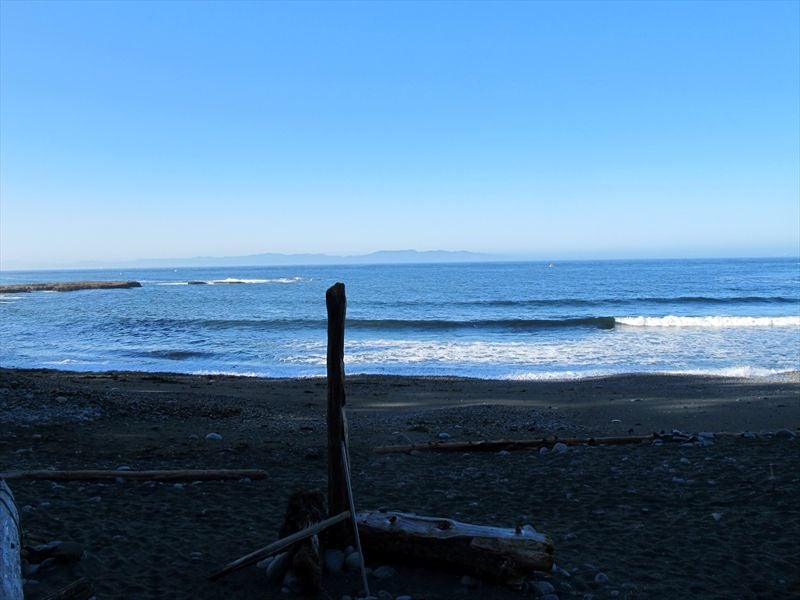
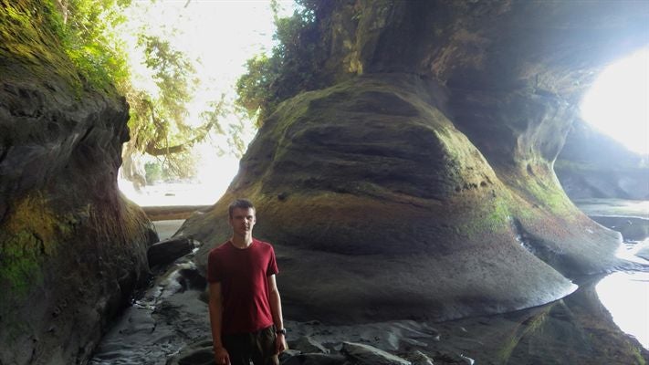
We (Steven, my friend from work and S&R, and my 13 year old son, Daniel) started out from Mackenzie at 7pm, drove all night to Vancouver (not recommended), and caught the first ferry out of Tsawwassen for Swartz Bay (Victoria). I slept on the ferry the whole way. I should have gotten Steven to help out with the driving, but it was my dad's truck, and if anything happened to it, it'd be on me anyways, so.. The winding road from Victoria to Port Renfrew was a bummer, stuck behind RV's and buses and no place to pass.. We took a side trip down to Sombrio River, a part of the JDF trail, just because we were doing good on time, and the rain seemed to be letting up somewhat.


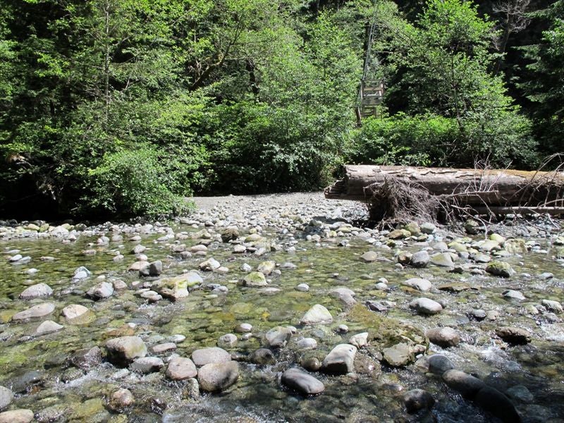
It was a good insight into what we had to look forward to with regards to camp sites, mud, and beach travel (soft sand, gravel does wear one down).
We made it into Port Renfrew and scoped things out (the dock, where to park, etc),

then we checked into our ‘hiker hut' that the Trailhead Lodge runs. They were actually better than I was expecting. Decent mattress, bedding, heated, lighting, the detached washrooms not TOO terrible (abysmal water pressure in the shower, but hot).


Then, with still a lot of time to kill we decided to go to the Gordon Bay Information Center and get the orientation over with. We also wandered around the Gordon River camp site close by while waiting for the indoc to start.. It was about 45 minutes, and we learned there that the weather was supposed to be clear up the day after, and hopefully for the extent of our hike, so that was good..
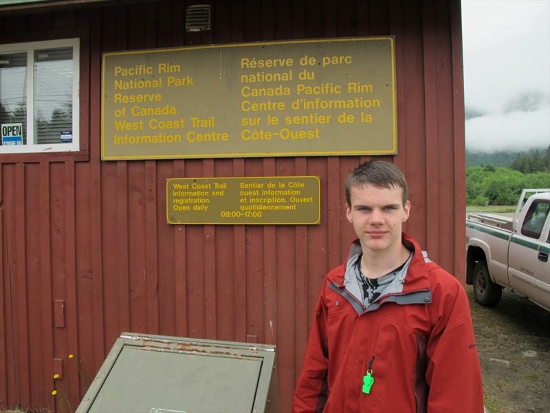
After we got that out of the way (we would still be required to sign in at the Pachena Bay Information Center), we got something to eat at the Coastal Kitchen Café right across the street from the hiker huts. Really good burgers, nice décor. Steven stayed at the hut, as he is quite cheap when it comes to eating out, among other things (though thankfully not when it comes to chipping in for gas money and ferry crossings).
We got showered up and made an early night of it, as we'd need to be up around 5am for the JDT water taxi the next day. I phoned Svetlana on a pay phone at let her know we'd be out of touch the duration of the hike.
Day 1 – Pacheena Bay Trail Head to Tsocowis creek, 17km.
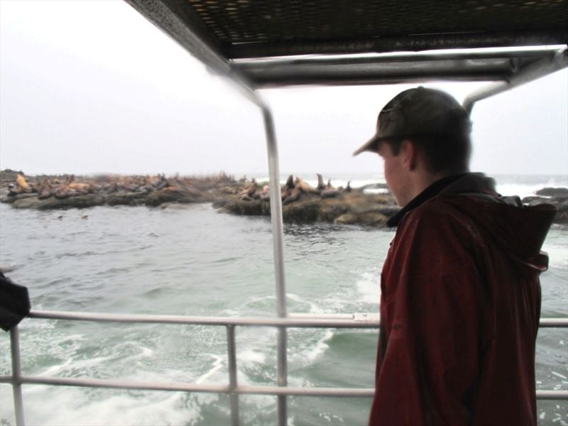
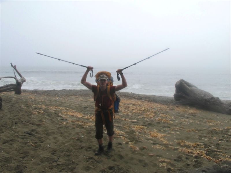
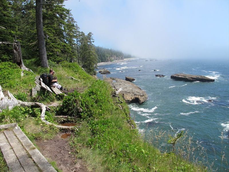
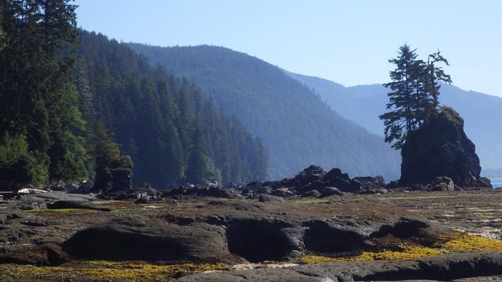
I didn't end up sleeping very well, as I forgot to shut off the baseboard heater and I woke up in a sweat sometime before 5, and had to leave the door open for a while. So 5 am came much too early, but we got organized and made it to the boat on time, with time run and get the truck parked at Evan's ($30 for the week). The weather was the same as it had been yesterday, misting to downright pouring. The captain, Brian, was very nice and had plenty of good tips for the journey. There were three Americans on the boat besides us, and they were doing the WCT the same day as us (they had also been our neighbors in the hiker huts, if we'd bothered to find out). I was a bit disappointed we weren't going to have sunny skies for our boat trip (heavily overcast and raining), but it was exhilarating going along at such a clip with the swell and spray of the ocean, and we did get quite a good look at the wild life. There were 2 or 3 grey whales that were breaching within 15 feet of us, but I didn't get a shot due to the rain and the speed of their surfacing. We had a look at Thrahser Cove campground, and we stopped in at Moniques to pick up 2 older women that had had enough and wanted a ride into Bamfield. We also stopped by the sea lion haul out rock by Pachena Lighthouse and it was lousy with them. The females leapt off the rocks and came up to investigate. Very neat. So, no very good views but still worth it!


We pulled into Bamfield Harbour at around 9:30, and waited in a café for the bus to take us to the WCT Info Center. The PLAN was to camp somewhere near the trail head and start early the next day, but Steven convinced me we should make a start today, as who knew what the weather would end up being like over the next 6-7 days. So fair enough.
We took a good 1.5 hours between signing in, asking again how to make sense of the tide tables, and getting our gear together, but we were on the trail by 11:30, same as the Americans we boated over with. We took the short beach route to Clonard Creek to start.


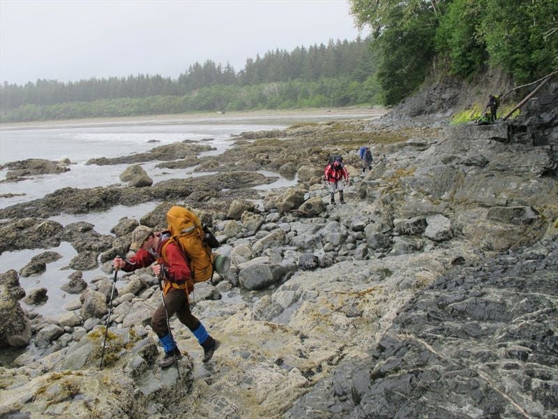

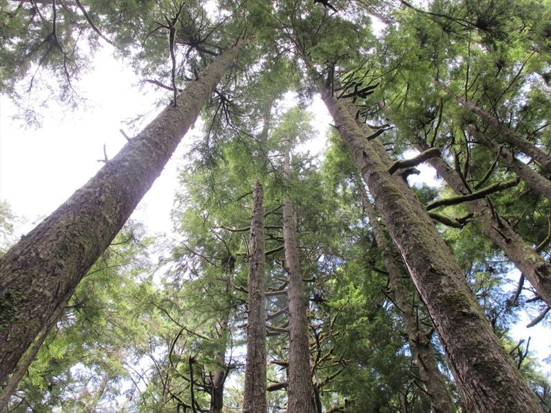
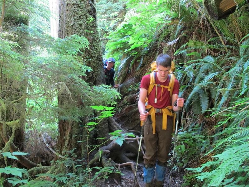
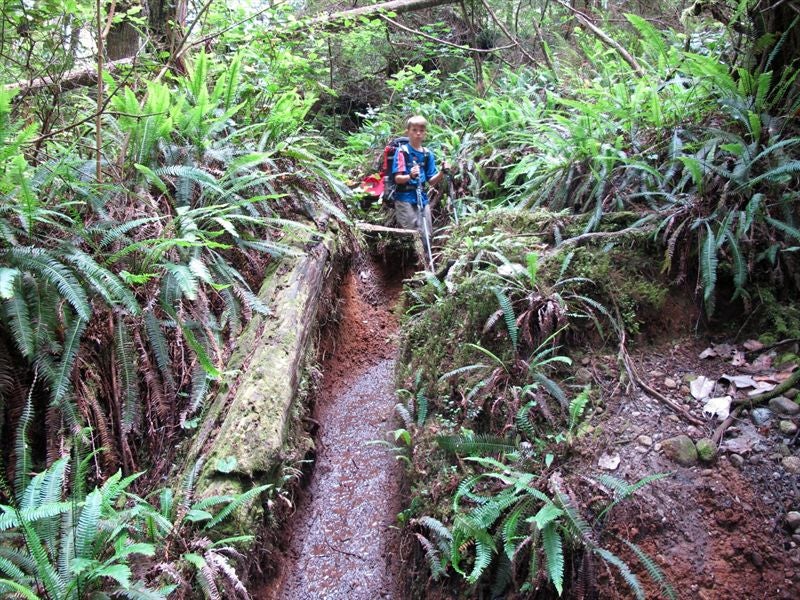
But we were into the dreaded inland trail soon enough.. Very soon we were daunted by the notion that this is considered the ‘easy' part.. We took off our shell jackets pretty much immediately, as we were getting too hot and sweaty in them, even our baseball hats were too much. So the rain was actually quite refreshing.


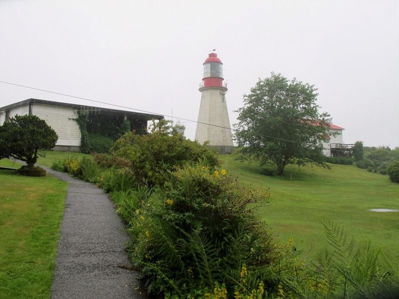
We stopped at the Pachena Lighthouse for a break from the rain (we sat under the covered entrances of one of the outer buildings), got into our mid layers, had a bite.

We tried hiking in the shells again, and again they lasted about 10 minutes. We had a look around the Michigan campsite, but there were about 10 people already there, tarps all over the place. So on we went.


We made it over Darling River (or is this the Michigan?), but had to take the boots off for Orange Juice (or was is it Darling, and the Michigan or OJ one was okay? It was a bit of a blur by then).


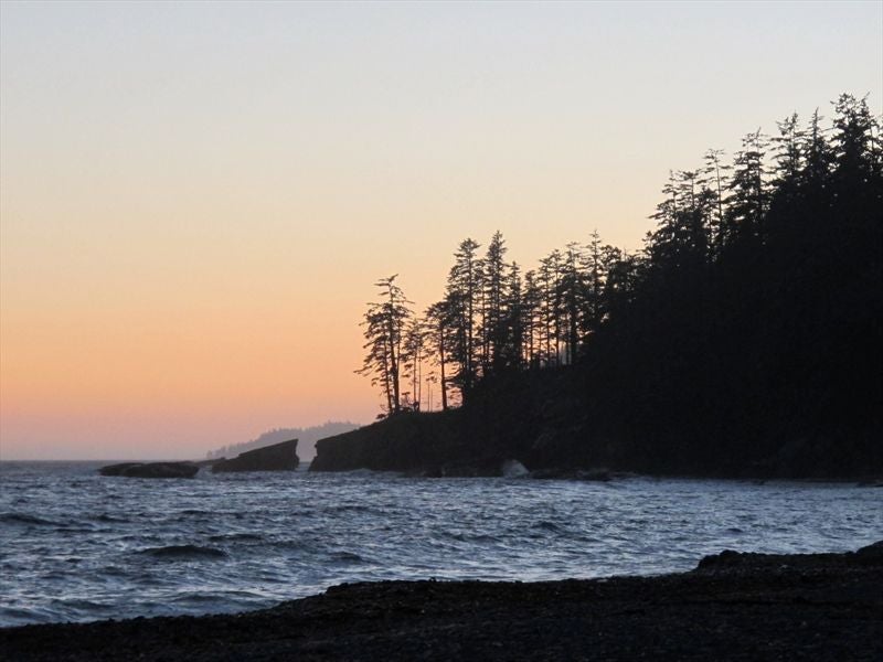
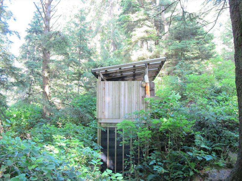
We pulled into Tsocowis Creek at around 6:30, and it was a welcome site. We didn't do much exploring besides the Patrol Cabin to refill our water (they had a rainwater barrel), the bear bins, and the toilet (the wood chips they use for composting makes pretty good tinder), as we were bagged.. I farted around for way too long setting up a tarp over my clothes line in case the rain started up again (it didn't). But I was soon to learn how useless a gesture it was, and that stuff is dried by the fire or nothing (unless you get out them early enough in direct sun). We also wasted a lot of time finding dry wood for a fire that, after getting something to eat, we spent maybe 20 minutes around before going to bed.. It wasn't cold at all, and muggy besides. I didn't hardly use my sleeping bag. There were 4 people in tents right beside us that also turned in early, and maybe 2-3 more couples by the river/waterfall. One woman said she saw a bear, but didn't sound too worried about it, so neither were we (besides not camping by the noisy river/waterfall).


 Day 2: Tsocowis creek to Tsusiat Falls, 8km
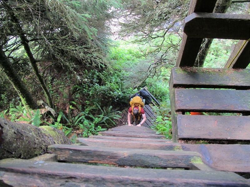
We slept till 9 the next morning, and it took us about 2 hours to break camp and get on the trail again. We discovered once on the ladders that the waterfall was pretty cool and we could have checked it in more detail last night. Oh well..


As promised at the info center the day before yesterday, the weather was improving rapidly.


But the trail didn't get the memo..

So it was good when we were able to get onto the beach again..


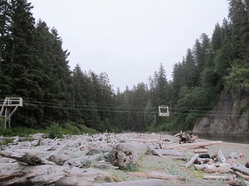
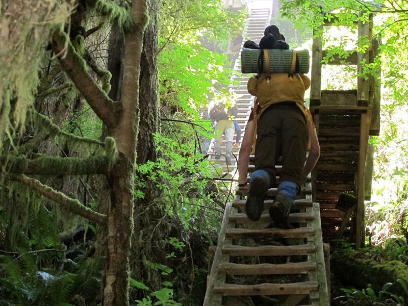
We came to our first cable car at the Klanawa River, and very quickly deduced that with 3 people it's much easier going one at a time, and the guys on either end do the pulling, with the guy in the car just enjoying the ride (and NOT banging the heck out his elbow).


Heading inland again was a bummer.. Mud, root, mud. No real views, even when we did get a glimpse of the ocean, but at least it was bright and green.


We did see a couple people from Mackenzie on the trail heading the other way.. Small world!
So when we saw the Tsusiat falls campsite at the bottom of all those ladders I'd already decided we were taking an easy day, and no amount of Steven's passive-aggresive mumbling about fexibilty down the road was going to budge me. It was about 3:30 when we made it to the camp.


The sun and breeze was nice, and the shirts and boots came off at lightning speed. We scoped out a good site while the getting was good (there were about 15 people in the camp, then).


We saw just a little off the coast what looked to be 1 or 2 orcas in pursuit of a grey whale, but I can only be sure of the grey whale. Steven has better eyes, and said he saw 2 fins at one time..


When we finally were able to pry our eyes off this we went for a dip under the Falls, which was beautiful..


Too late, I thought to get a clothes line up (and just as uselessly as last night).

No fire tonight, as we were as tired as we were the night before, if not more so. We just had energy to get something to eat before heading to bed (Daniel had in fact snoozed in the tent while I washed our shirts/socks, and got food ready). We had an early morning get-up planned for tomorrow, so we could get through the ‘hole in the wall'. We could see it in the distance, but didn't feel like walking all the way over there when we would see it tomorrow. Daniel and I both managed to burn the heck out of our backs being out in the sun too long without sunscreen (good thing I packed it!). You don't notice it till it's too late, with that ocean breeze.


 Day 3 - Tsusiat falls to Carmanah Creek, 21km
We woke up at 5:30 to fog, and were kicking ourselves that we didn't check out the ‘hole' yesterday under blue skies. We also regretted our sunburns when climbing into our packs.. But we got underway by 7:45 and made it to the ‘Hole' in plenty of time to beat the tide and round the point, so we didn't need to get up quite as early as we did, but oh well.


We headed inland at the obligatory beach access.


I never did see the cave mentioned in Blisters and Bliss that is apparently at the 31km mark or so, and is big enough to camp in. So it's good we stopped at the Falls, as there wasn't another till past the Narrows, besides the ‘glamping' tents..


We made it down to Nit Nat narrows and waited about 20 minutes till they came to pick us up.


It was foggy, so we shouted out a couple times that we were there.
When they did come, it was with a hiker going the other way, and we soon discovered how close we were on the other side, so know knows, maybe they got pissy with our shouts and we would have been waiting even longer if not for the other hiker..


We stopped for lunch, and the choice was salmon, some other fish, and crab.
We picked crab, at $25 a plate, with $7 strawberry smoothies.


It ended up being a pain in the ass to eat, so remind me next time to get the salmon..

It got busy around then, so we hit the road.. At least the fog had burned off a bit..

We were able to make up some time with the good sections of boardwalk, and it was shaping up to be a nice, sunny day.

Which quickly turned miserable (I should have taken the beach section by Cheewat, but I stupidly equated no camping with no access).
We did have one section of beach that was like a super highway, but over much too soon (only a little over a km).


We had to go back in to get around a headland.. The longest .5km of our lives.. But at least we could say we'd broken the back of the WCT..

38km marker!!
But we got back to the beach as quick as we could (access A), even though getting around one of the headlands was a bit tricky..


We grabbed some water at a creek at the 40km mark.. Daniel was pretty spent by now, and only the promise of a burger at Moniques kept him going..

When we made it to the Cribbs campsite we should have stopped, as it looked good (easy access to water, toilet, nice people to chat with), and we had put some good km's in..


But I'd promised a burger for dinner, and that's what we were going to have!


We finally made it to the Carmanah Lighthouse, which we were told was just before Moniques, so we were encouraged..

But those stairs pretty much did us in, after so long a hike already..


But ours is not to question why.. The end was in sight (almost), so we limped along the little bit of inland and stairs and finally made it to our destination at 7:30.


Ahhhh!

Ahhhhhhhhhhh!


Ahhhhhhhhhhhhhhhhhhhhhhhhhhhhhhhhh!

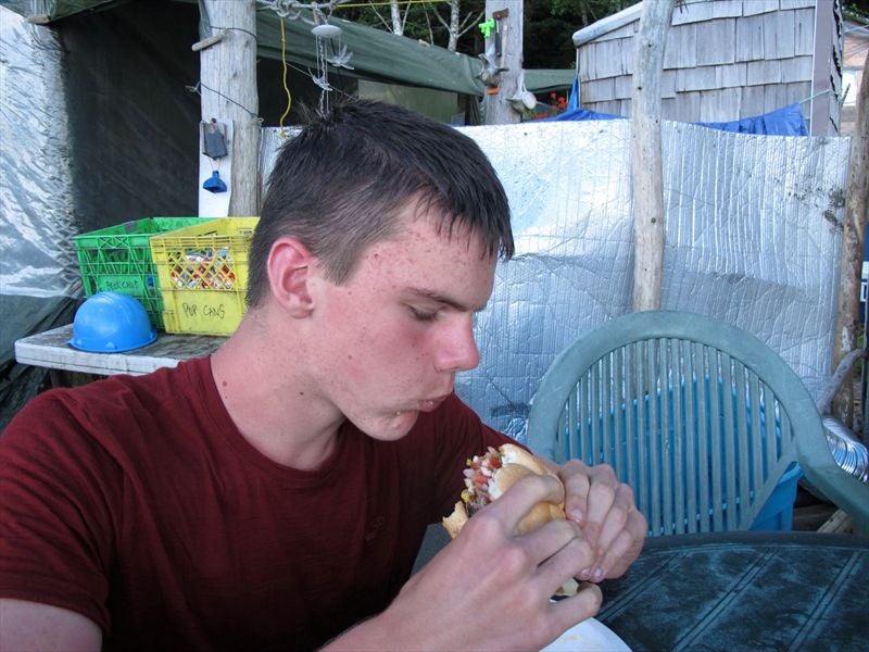

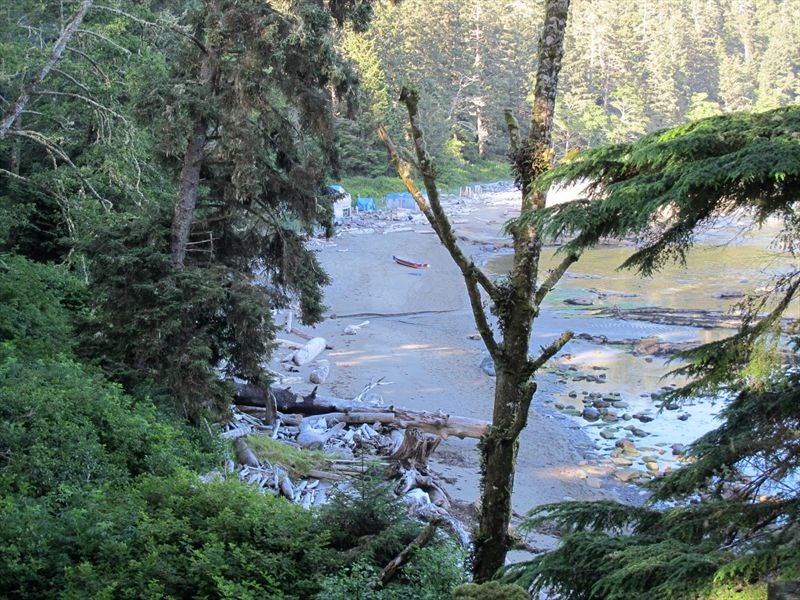
The first and quite rightly the best $25 burger and $9 beer I've ever had.. ALMOST worth pushing past Cribbs for(it would have made just as good a lunch the next day, I'm sure).
I thought Monique was an older lady, but the one we saw was fairly young.. We spoke to an older guy who offered to let us stay in a shelter they had set up for bushed hikers past their limits.. But we weren't there yet, and we(well, Daniel and I) were thumbing our noses at the pure hiking tradition as it was! So thanks, but no thanks.. He also gave us advice regarding Owen Point. To wit, that we should go down at beach access A, drop packs at B, and head out to Owen Point, then scoot back and continue on on the inland trail. He said it wasn't worth the risk of injury pushing on to Thrasher, and he'd seen/heard plenty of horror stories from novice and veteran alike. He had sized us up, we told him we were coming from Camper, so he knew we were fairly serious hikers not easily scared off, and still he warned us off, so we took that warning to heart. Myself, I'd have done it, but I'd never forgive myself if we made it all that way only for Daniel to break his collar bone or worse. He also told us we were better off camping inland at Log Jam Creek rather than spending an hour(1) on the ladders each way. And so, once more into the breach, dear friends.. We heaved our packs on and stumbled onwards to Carmanah Creek (thankfully all beach).. Daniel was bringing up the rear, only slightly mollified by the rest and the meal, poor guy..


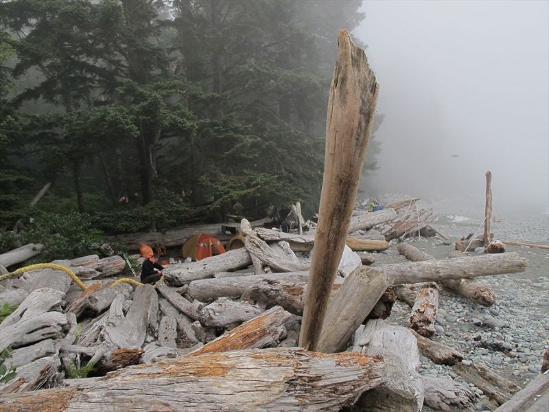
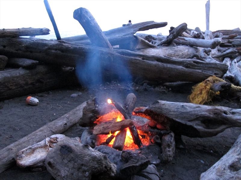
We got set up by around 9pm. We were the only idiots to push so far, besides a guy and 3 girls that camped beside us and had run into a couple times that day, including Moniques. We got a nice fire going, and we were able to dry out the socks I had so foolishly decided to wash back at the Falls. We were changing them out fairly steady, so there were about 6 pair to dry out.. The boots dried out not too badly also. Good dessert of instant pudding with milk powder..


 Day 4 - Carmanah Creek to Walbran, 7km
Loathe as I was to perpetuate the pattern of hard day/easier day we'd established, we needed a rest day.. So we slept in, had a leisurely breakfast, and never mind the hikers huffing to and fro past our campsite (the most we'd seen up to this point).


The plan was to just enjoy a beach day, so that's what we did.. We headed out around 11 am, and we met about 10 hikers on the beach this day, the most we'd passed on the trail so far, and we stopped for brief chats centered on camp destinations and trail conditions.


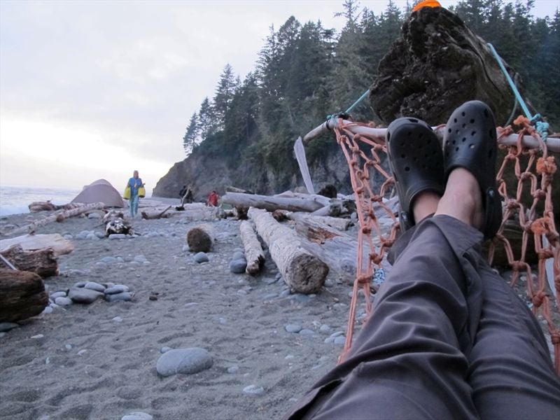
We made it to the Walbran creek camp site after going along the creek inland for a 100m or so and using the cable car, and found a really good campsite just off the beach and close to everything.


We got our tents up, and then went for a swim.


Our timing was good, as the fog rolled in just as we finished changing back into our clothes.

But after a few hours it blew off and we enjoyed our first (for me) unhurried camping experience thus far.


 Day 5 – Walbran to Camper, 9km
Another hard day today. All inland, LOTS of ladders, LOTS of mud.. all inland!!! ?
But it was a relatively easy morning, and we'd had a good night last night, so we had that to cling to, pushing forward..


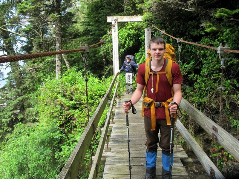
The suspension bridge was pretty neat, but the ladders to and out of it sure weren't!


When you get off the bridge heading south, make sure you take the path to the right! The one to the left looks equally well-travelled, but who knows why, as 100ft in it quickly turns into a bushwhack to nowhere.. So that was frustrating (I'd gone into it way too far, hoping it would turn back into a trail)..
On the south end of the suspension bridge I came across a tent just lying in the muck.. So, hoping to earn my wings for the day I picked it up to hand into the patrol cabin at Camper. Steven mentioned that he'd overheard back at Walbran that some North-bound hikers had lost their tent on the way there.


We made it down to the creek bed and stopped for a snack and a water refill.


My extra burden (tent I found):

We saw the path to the Culite Cove campground, and kept going.

The last 4km were TOUGH..


But finally we saw the light at the end of the ladder:


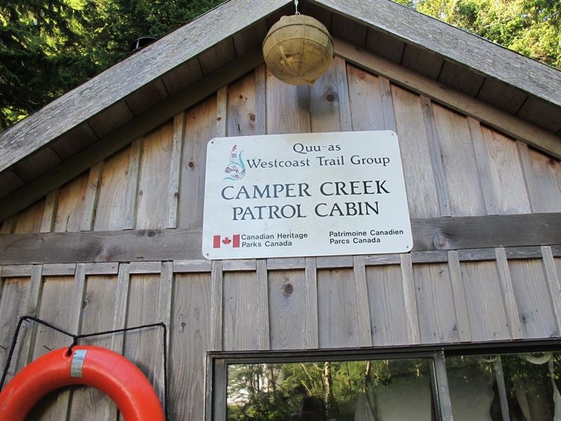

I went to go drop the tent off at the patrol cabin, but nobody was home, so I hung onto it and would try again later. But I knew I wasn't hauling this 5 lbs of good karma any further. And, as it turned out, it was more of a curse..
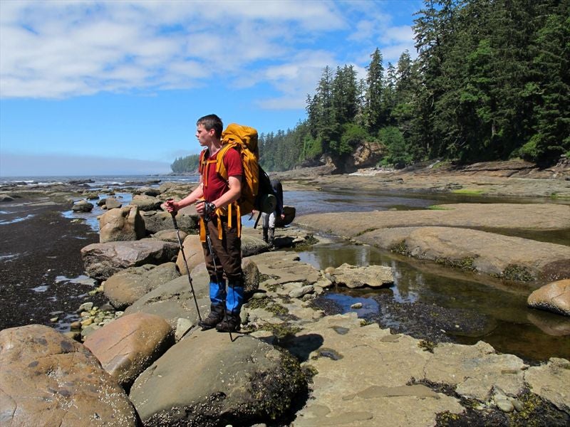
After we picked a camp site I wandered across the river and had a look at the ocean. I saw a guy going along the shelf, and I decided to do the same..


The last picture from my camera:

But the one time I don't put on the camera strap I slip on some unseen bit of green algae, BANG, I'm on my knees , camera flying into the water (in it's protective case for safety, of course).. I just look at it, in shock.. Before it has time to sink into the water I have a brief flash of me diving in after it (and really, I could have, couldn't I? It wasn't like it was a surge channel, and I didn't have a pack on).. Still in shock, I fish it out as it washes up on shore.. Wow. All this way and a brief, idiotic moment wrecks my camera and erases all my potential memories. I try it, and of course it's dead. My one hope is that the SD card still works, so I take it to one set of hikers and tell them my sad tale. They stick it in their camera – memory card error. Ouch.. So, I stumble back to our site, and break the news to Daniel. To his credit, he's all sympathy, and I get one of the best hugs from him since "he's gotten too big for these things". I set up my tent and try to keep a brave face on. Not the end of the world, right?
Steven had I guess mentioned to one of the hikers I swapped SD cards with that we were carrying a tent that someone had dropped, and as it happens it had been with them that these north-bound hikers had had the conversation Steven had overheard at Walbran. So they had the contact info for the owner, and had apparently left a note on it with the info as they passed by it on the way to Camper's.. It must have blown away or something, as there was no note when I grabbed it up. So I gave them the tent to leave at the patrol cabin with the particulars. I was past caring.. So much for good karma!!
With the camp up I wandered around in a dark fog looking for firewood. I struck up a chat with another hiker, and with a flash of inspiration I thought I'd try my SD card with his camera, on the off chance it was just the make of the other camera that was the problem, and success (obviously)! I was really relieved. I know I would have paid the price of the camera for someone to be able to retrieve those images for me. With that weight lifted I was much better company, and I learned that they (a man and his young son (10, maybe?) were south bound, and had gone the whole way around Owen Point. I mentioned this to Steven, but he was still resolved to give the hard section of Owen point a miss, with his awkward backpack and steady refusal to use the poles that I'd convinced him to bring (he gave up on them about 30 minutes into the hike).
So at least my SD card worked. I would try to swap out cards with other hikers if the opportunity presented itself.
We got a good fire going, and did a good job of drying our socks and shoes (again). A German by the name of Paul (20?) walked by our camp, also wondering about Owen Point and the tides. We said we would get him up when we did, and he could join us if he liked. He said he'd like that.
Day 6 - Camper to Gordon River Trail Head, 13km
So we got up around 5:30 again, and broke camp in record time (about 1 hour, 15 minutes). We gave Paul until 6 then woke him up, as he'd be faster packing up. We were all of us ready by 6:40am, and got on the cable car. SNAP! One of my poles gets caught as I get out of the car. *#@! But I take it more or less in stride, and just hope it's not coming in 3's.. Paul's camera is compatible with my SD card, so that's a bonus, and I snap as many pics as I dare. The air is clear, the forest is beautiful in the early morning light, it is great to be alive..


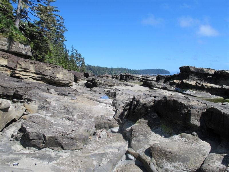
We make it to beach access A and go along until we get to B, where we drop our packs (except Paul, he wants to carry on to Thrasher) and head on to Owen Point. There are a few chasms to jump over, or around, into the bush.. If you get to the beach where there's an option to go on the beach, or up into the bush again (2nd or 3rd one, I think), take the beach route on the right.. The left one into the bushes is for people trying to beat the tide back to B, and it is a bitch..


We get to Owen point by 9am and spend about 20 minutes there. It's a neat place. From access B to Owen Point is 20 minutes, tops..


Paul heads off towards Thrasher Cove, and promises to send me some photos and describe how it was for him getting in, the ladders out, etc. We'll see if he follows through.
We head back to our packs and get there by 10am and have a snack.
After another 4 km of inland we reach the access for Thrasher campground, but as we decided earlier to camp at Logjam Creek we push on. It's not that much further, and we resupplied on water.. We don't see where this supposed creek-side, camp-friendly area is, and really, it's only 1pm, and another 5km and we're out.... So, we decide to go for it.
It starts to get steep after the creek, but that's ok, as it gets steadily drier, too, which is a nice change of pace. It's a beautiful hike, now.. There's finally no mist or fog in the forest, so it really pops. I feel like an Ewok is going to jump out at any second..
We start to run into hikers fresh off the Gordon River ferry, and I mean fresh! Full of piss and vinegar, nary a mud stain or hair out of place.. I'm too embarrassed to ask for a memory card swap, so we rely on Steven's cell phone camera. If he ever figures out how to retrieve them I'll post them forthwith. I asked 1 or 2 hikers, but they were carrying Iphones only.
We can hear the boats and see the water of the port, so our pace quickens.. Finally we can see Port Renfrew itself on the opposite shore through the trees.
We made it to the ferry JUST as the 3:30 one was getting ready to leave..
Cue: "We Are are the Champions"
Much back-slapping and shoulder-punching ensues!

We sign out at the info center (luckily the ranger does this before the 3:30 indoc for the hikers going in). Then we get Evan to pick us up from the Info Center. It feels weird to be in a car again!
We grab another burger at the Coastal Cafe, but it's no Monique's..
We also grab some T-shirts at the Lodge gift shop..

What a great hike! Our first hike over 3 days, and first over 25km. Very impressed with how Daniel held up.. We drove to Nanaimo and decompressed with a friend of mine for a day before heading home..
SALIENT POINTS:
Whoever says this trail is too busy either hasn't done it, is unusually bothered by the sight/sound of people (I'm a bit of a crank in that regard, but I was fine), this WASN'T the WCT at it's busiest, OR a perfect storm of the later two.. For ourselves, we saw a max of 15-20 people (6 people on average) at the campsites, and passed maybe the same number on the trails on maybe 2 out of the 6 days..
And the camps were not noisy at all.. Everyone was considerate and generally too bushed for loud, boorish behavior. Everyone was friendly and encouraging.. We saw the fishing boats, cruise liners, container ships off shore, but never heard them besides the odd speedboat as we got close to ports and coves.
Pack weight: Me and Daniel, 36 lbs each without water. Steven about 40, with water.
I was expecting to camp on the beach the first day off the JDF water taxi (the 6th) so I brought food for that on top of what I'd packed for the trail, and of course I took it with me onto the trail, so I've added 2.5 lbs and 3000 calories to my total. It was trail mix noodles, and some cookies.
Calories: 38,0000 + 3000 cals
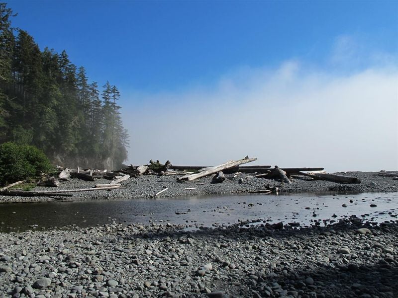
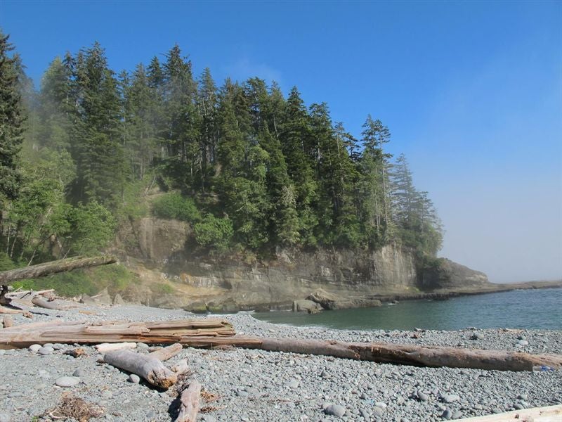
Weather: First day was varying degrees of rain, from misting to just pissing down.. The rest were pretty much all sun, with fog and mist on the beaches in the mornings and afternoons, even on the inland trail in spots.
Predicted camp sites:
Day 1 - Pachena Bay Trailhead to Darling or Tsocowis creek (17km)
Day 2 - Darling or Tsocowis Creek to Tsusiat Point (hole in the wall) 19km
Day 3 - Tsusiat Point to Carmanah Creek 13km
Day 4 - Carmanah to Walbran 7km
Day 5 - Walbran to Camper 9km
Day 6 - Camper to Thrasher 8km
Day 7 - Thrasher to Gordon River Trail Head 5 km
Actual camp sites, km's travelled:
Day 1 – Pacheena Bay Trail Head to Tsocowis creek, 17km
Day 2 - Tsusiat falls, 8km
Day 3 - Carmanah Creek, 21km
Day 4 - Walbran, 7km
Day 5 - Camper, 9km
Day 6 - Camper to Gordon River Trail Head, 13km
We fell into a regrettable pattern of pushing too hard one day, then sleeping in to recover from the day before, getting a late start the next day and stopping early, then getting up early the next day to compensate for yesterday, pushing hard, repeat. We would have been further ahead spreading it out a bit more.
Camp sites/mileage we probably SHOULD have done:
(I say probably because we never checked out Bonilla point - I don't even remember passing it, and we didn't go to Thrasher, fearing the ladders)
Day 1 - Pachena Bay Trailhead to Darling, 13.75km
Day 2 - Darling to Tsusiat Falls, 11.25km
Day 3 - Tsusiat Falls to Cribbs, 16.5km
Day 4 - Cribbs to Bonilla Point, 6.5km
Day 5 – Bonilla Point to Camper, 14km
Day 6 - Camper to Gordon River Trail Head, 13km
Favourite campsites in descending order:
Tsusiat Falls, Walbran, Cribbs (we didn't stay here, but it looked awesome), Tsocowis Creek, Carmanah Creek, Camper Bay.
Favourite foods on the trail in descending order (Besides Nit Nat and Moniques):
Costco dried mango and Costco yogurt-covered fruit and nuts, congealed into one: Best thing since someone got peanut butter in his friend's chocolate (and vice-versa)..
Banana Instant pudding with dried whole milk. Shake, shake shake for a few minutes in a sealed container (GSI Fair Share mug, in our case), and Bob's your uncle.. Peanut butter optional.
Quaker oats instant oatmeal packets. 3 of these in the morning with a flavoured tea bag and some peanut butter and dried banana really hit the spot, and even on their own straight out of the packet they taste great.
Hot cocoa: Equal parts 1.5 tbsp cocoa, sugar, and whole milk powder (Nestle Nido). Starbucks Via packet optional. Way less sweeter than commercial mixes.
Least favourite foods:
My homemade turkey jerky: Too tough (we didn't have the patience to let them soften up in the noodles), too salty. Next time we'll stick to the commercial varieties?
Noodle packets with flavouring: Noodles are ok, but flavour packets way too salty..
Dried kiwi: I left the skin on, too much hassle taking it off.. Not a good idea. We'll stick to bananas and strawberries from now on.
Regrets:
Buggering up my camera and hiking pole due to stupid lapses in judgement, obviously. But all things considered it could have been worse and I'm thankful we made it through in good spirits, without injury, AND with the memory card of my camera intact. That would have sucked to have made it so far and then lose the tangible images from the trip. Even after only a week it seems like a dream, so it's very nice to have the evidence!
Not waiting one extra day so we could have sun all 6 days of our trip. BUT this would have required predicting the weather to a certainty, AND by getting that one day of rain we can say we've experienced the true WET Coast Trail, at least in part.. I am glad we didn't have to contend with wet stairs, ladders, and boardwalks, and setting up and taking down camp would have been miserable.. It would have meant no fires, too.
Pushing too hard and sometimes getting into the bad habit of not looking beyond the next tree root. Luckily I had my camera and had an excuse to stop and take it all in every once in a while..
Things I could have used:
Rain pants: For the JDT water taxi, at least. And for the first day of rain in camp they would have come in handy for sitting down in and n


 West Coast Trail, July 6-11,2014

 id you like the one that leans towards the abyss?
 Not this guy, I dunno how old he is, but this is the youngest one I got a picture of (day 5).


 Your Privacy Choices