Much belated trip report (2005) prompted by discussion in another thread
https://www.clubtread.com/sforum/topi...TOPIC_ID=50758. Below are my notes taken shortly after the trip, I just never got around to posting them. Given this was a number of years ago, don't expect the route to still have flagging. I had both the 50k and 20k maps at the time so the peak elevations mentioned would be from one of those two maps.
----
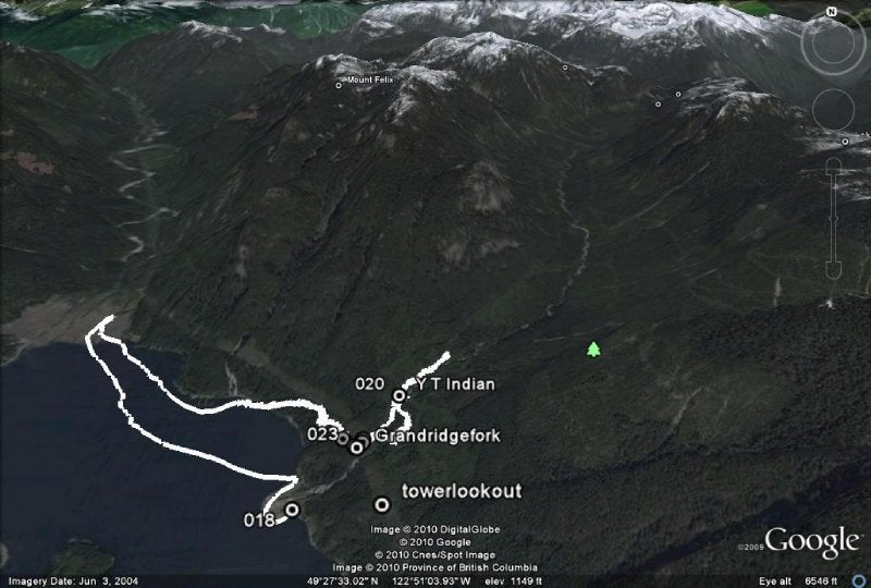
11:45 - Left Granite falls, headed up a trail 20m past the sign at the top of the public dock. At the top of the trail is a chain link fence and some old stone building sections. This turned out to be a dead end. Came back down that trail part ways and noticed a rope assist heading up. This lead up the north side of the falls. It was quite a scramble in places and would be difficult when wet and slippery or in when the water level was higher. The first bridge was washed out and there were no obvious crossing points, so I continued up the side of the creek. The second bridge washout wasn't obvious, however the river forks and according to the map, the trail should have been right near there. 10-15m off the north side of the river I saw the obviously marked trail. There was also a junction with a sign saying the trail goes to the Indian River bridge crossing in one direction. I headed up the old partially overgrown forestry road (long sleeve shirt and pants necessary), taking a right at the fork and crossing over the river in a large rockslide area. The continuation on the other side of the river (not very big this time of year) wasn't immediately obvious but once I found the flagging, it was very well marked the whole way.
2:00 - Came to the last major river crossing (Flume Creek?) before leaving the forestry road heading up the ridge. The bridge was non-existant, but the crossing was easy since the water level wasn't high. There was plenty of water here in mid August for fill up though. Filled up with 5L of water and rested for 30 min.
4:30 - After many, many, many false summits in 30 degree weather, I came to the lower summit on the ridge (1198m on the TRIM data topo).
5:15 - Stopped for dinner in a flat area part way up the next section of the ridge.
6:15 - Finished dinner and started heading up the ridge again.
7:00 - Hit the top of Eagle Ridge (1347m summit). Decided to continue and head for the next, smaller peak (1159m).
8:00pm - Arrived at the saddle after the 1159m peak (before the larger 1249m peak) and made camp for the night. Both this saddle and the one previous had a couple of ok hammock spots. The peaks had nothing at all.
5:45am - Got out of hammock.
6:15am - Hit the road, no breakfast yet.
6:50 - Summited the 1249m peak and started to make some breakfast. In hindsight, I probably should have had a quick morning snack before heading out in order to build up some energy... the peak was tough and I think I had a bit of sunstroke from the day before.
7:30 - After a 40 minute breakfast, I started down the mostly easy, long descent.
8:30 - Sub-peak before the 1221m peak. I thought the 1221m peak was the last peak since the 50,000 scale map seems to show the trail skirting below the 1224m peak, however I'm quite sure it went right over the top and then down and side-sloped it across the boulder field and around the top of Lighthall Creek. After the boulder field, it was a nice pleasant forested walk up the hill to the tooth saddle above the Dilly Dally trail.
10:15 - Tooth saddle above the D.D. trail (directly east of the 1196m peak). The map shows the junction between the Indian Arm trail and the D.D. being here, but I don't believe the D.D. goes up that high. I headed down the other side of the saddle, looking for the junction. At some point, the trail did start to get a lot nicer, so perhaps I just missed the junction at the top. After about 15 min, I came to tree with two markers, one pointing left with the writing worn off, and the other pointing right labelled Buntzen Lake. Unfortunately it appeared to be in the middle of the trail and there was no other trails going left or right.
10:30 - In any event, lets call that the Dilly Dally/Indian Arm junction. Near this marker, there was also a tree with a pink band all the way around it about 10 ft off the ground. Immediately after, the trail does a few quick switchbacks and goes steeply down the hill. This part of the trail was very obviously part of the Dilly Dally. After a few switchbacks, I noticed another tree with a pink band all the way around.
10:40 - Dilly Dally crosses the river. There was a small stream of water here.
12:30pm - Gravel road at the bottom of the Dilly Dally.
1:00 - North Beach. Rested here for an hour.
2:00 - Done lunch, headed for the South Beach and then the bus stop.
2:45 - Buntzen parking lot.
Total Time: approx 16 hours hiking (including breaks for meals and rests, but not overnight time)
Total Distance: 21km, 12km from Granite Falls to Dilly Dally junction (as measured on GoogleEarth, trail guide pegs it at about 20km)
Avg Speed: approx 1.3 km/hr
Weather: 30 degrees the first day, high twenties the second

 Indian Arm Trail, east side - Aug *2005*


 Your Privacy Choices