Photoset:
http://www.flickr.com/photos/realawo...7624342737861/
Having turned around the last time I was up at Deeks (
https://www.clubtread.com/sforum/topi...TOPIC_ID=34905), I wanted to get up there again to knock off Windsor. On Saturday I did so - and tagged Deeks too while I was up there.
Elevation profile:

Google Earth birdseye:

Google Earth 3d:

Unlike last time I was up at Deeks Lake, I have a car that can actually drive the forestry road. That one really bad spot just after the gravel pit is as bad as always. I was able to make it up without any trouble with my new new (and more agressive) tyres, managing not to high centre myself in any of the ruts. A 4wd HC is pretty much mandatory. (That said, when I got back to the car after my hike a ~20 year old VW 4wd van was parked behind me, so if you can still make it without HC as long as you don`t care about your car.)
Google Earth 3d - trail to the lake:

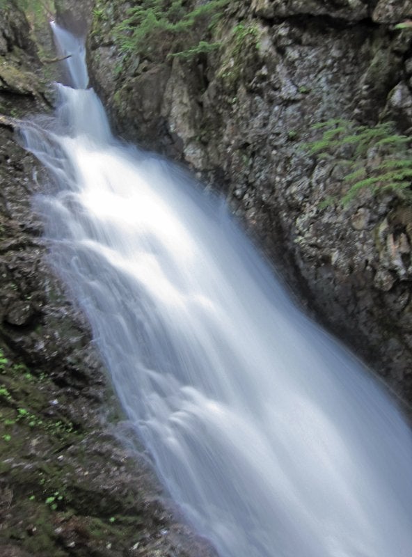
The trail up to Deeks Lake was in good shape and there is really nothing to comment on. Lots of water in Deeks Creek from all the melt of the last week. Still getting the hang of water photography:
Took the trail heading left just before the lake and stopped for a quick snack at the small boulder field at the NW corner of the lake:


I had some bug stuff on, so the few biting insects were keeping their distance. There were many other types of flies buzzing around and annoying me though, so I didn`t stay in one place very long. Set off up the Deeks-Windsor col.
Google Earth 3d - up the col:

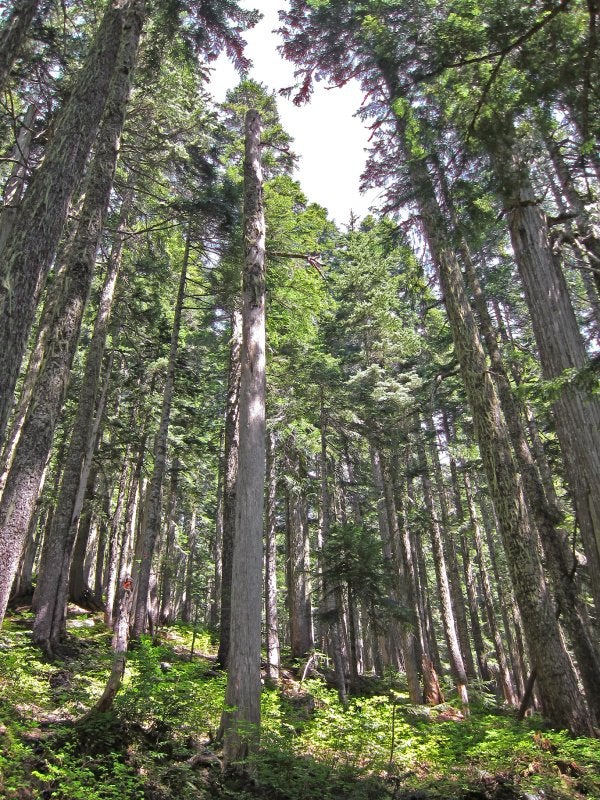
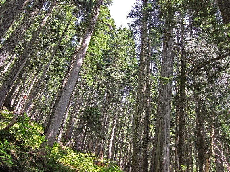
I really like the forest along this trail. Open (after the first stretch), lush, lots of little streamlets here and there. The trail is well marked (flagging tape and red diamonds), so if on occasion you get off the trail (it`s a little indistinct at times, and a few minor deadfall-caused detours), it`s easy to look up and see where you need to be.
Hit continuous snow at elevation 1350m. I had gambled by not bringing snowshoes, and I made the right call. Even though it was already warm, the snow was solid and I only sunk in half an inch.
Soon enough I toped out in a clearing at the col. Looking at my GPS I noticed how close Deeks was (when I did Deeks Peak loop last year (
https://www.clubtread.com/sforum/topi...TOPIC_ID=31291), I went up the Kallahne side and down the Deeks Lake side, but bushwacked part of the way down through the forest, so I hadn`t been on the col route before), so I figured I`d knock it off before heading over to Windsor.
Google Earth 3d - up and down Deeks:

I put on crampons, but more to justify having brought them as they weren`t needed. A few minor cliffbands to navagate around, and soon I was getting some nice views on the ridge leading up to the peak.

Video Panorama - On Climb to Deeks Peak
http://www.flickr.com/photos/realaworld/4780823487/
This got me to the following wall:
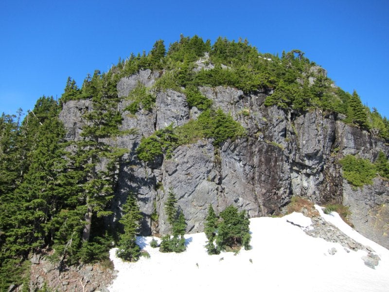
I remembered it from my Peak loop from last year - I remembered there being a bit of a trail on the southern side, which ended in a small boulder field - it was this boulder field that I had followed down before getting off trail and bushwacking for a while.
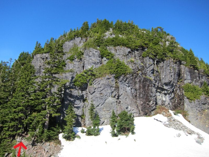
I dropped into the boulder field and tried to find the route, but couldn`t. Ended up on a nasty bushwack-veggie belay up that wasted time and energy. As it turns out, I went too low in the boulder field - I followed the right way on the way down, and it came out right on top of the boulders. If you`re approaching from the col, you basically want to hug the cliff walls - start off with a bit of a scramble step, then the trail should be obvious enough. Here`s what to look for:


After the nasty bushwack I found my way to the main trail and soon topped out on the summit:

(I know there is some debate as to whether this one or the subsummit along Deeks ridge to the west is the summit proper. My GPS had the other one as the summit, but Google Earth has this one at a few meters more elevation. In any event, this one is the one with the cairn and new (for me) summit register (thanks NSH).)
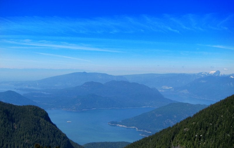
It was hot but not overwhelmingly so. Nice weather for nice photos:


1. Black Tusk, Garibaldi, Sky Pilot group, Mamquam, etc.
2. Deeks subsummits
3. Windsor
Panorama - Deeks Peak summit:

Video 360 Panorama - summit of Deeks Peak
http://www.flickr.com/photos/realaworld/4781461454/
Retraced my steps and was soon back at the col, and then headed up the other side.
Google Earth 3d - up Windsor

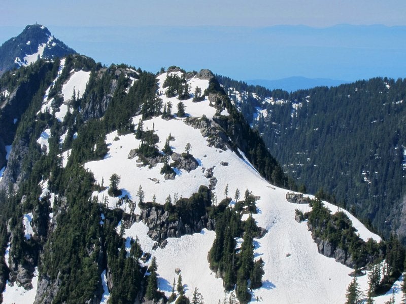
One or two steep snow slopes in the initial stretch, but the snow conditions were perfect for kick stepping and there were no risks to speak of. This ascent was much more open than Deeks, so I was climbing in the hot sun... at least the views were nice:
I wasn`t on the flagged trail on the way up (followed parts of it on the way down) but it didn`t matter as the way was straight forward and non-technical. Summited to great views.

Video 360 Panorama - summit of Mount Windsor
http://www.flickr.com/photos/realaworld/4780828585/
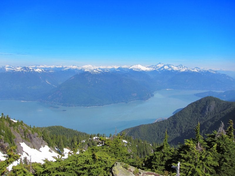
Panorama - Mount Windsor summit:

For people interested in conditions on the surrounding mountains:


1. Brunswick
2. Deeks
3. Hanover
4. Hat
5. Peak 5400
Horizon panorama:

The snow was softening up, but I was still able to descend and get down below snowline without putting my gaitors on. Back to the lake and out to my car.
One thing - is there a new map or guidebook that has mistakingly put the Brunswick Lake Emergency Shelter at Deeks Lake? A backpacker I passed on the way up said something like that, but commented that he knew there was a shelter at Brunswick and he was heading for that. On the way down I was stopped by a group of 4 asking how much longer they had before Deeks Lake and asking if that was where the hut was. Made me wonder.
-Ryan


 Deeks Peak and Mount Windsor - 2010-07-10


 Your Privacy Choices